
Lake Eğirdir
A large freshwater lake in the Lakes District of Isparta Province, south-western Türkiye, Eğirdir is divided into two connected basins by a narrow strait and ringed by mountains.
Lake Eğirdir is a large freshwater lake in Isparta Province, south-western Türkiye, lying in the inland region known as the Lakes District. It rests just over 900 metres above sea level inside a tectonic basin rimmed by mountains, and it is counted among the largest freshwater lakes in the country by surface area, covering roughly 470 square kilometres. Its most distinctive structural feature is a narrow neck that divides the water body into two connected basins, one considerably larger than the other.
Where the lake lies
The lake occupies part of the provincial territory of Isparta, in a part of Anatolia where several sizeable lakes lie close together. The town of Eğirdir stands at the southern end of the lake on a small peninsula that projects into the water. Along the eastern shore, Gelendost is the main settlement facing the lake, while Barla sits near the north-western side. The shoreline is irregular, with bays, small headlands and stretches of open water that give the lake a longer coastline than its area alone would suggest. The water is held in a closed basin, meaning it has no natural outlet to the sea.
Two basins joined by a narrow strait
Eğirdir is effectively two lakes in one. The southern portion is the larger and better known, and it carries the name Eğirdir. The northern portion, commonly called Hoyran, is smaller and shallower in character. The two are linked through a narrow passage where the shores close in, so water moves between them but the two halves behave somewhat differently in wind, depth and shoreline form. This internal division is the single clearest thing that separates Eğirdir from Türkiye's other large lakes.
Geology and the surrounding relief
The basin is tectonic in origin, formed by movement along faults in a region where the crust has been stretched and broken into a series of depressions. That geological setting explains both the lake itself and the pattern of neighbouring lakes nearby. To the west and south-west rise the Dedegöl Mountains, a rugged limestone range that includes protected high ground, while the Barla Mountains stand to the north-west. Slopes descend from these highlands toward the water, and the contrast between the steep, rocky flanks and the flat, open lake surface defines the scenery of the basin.
Water, fish and birdlife
The lake holds fresh water rather than the brackish or saline water found in some other lakes of the region, and it is used as a drinking-water source for the surrounding province. Its fish community includes carp and pike-perch, both of which have long been part of the lake's fishing economy; the lake has a history of commercial and subsistence fishing. Waterbirds are a regular presence, with grebes, coots and various ducks using the open water and the shallower margins. The wider Lakes District around it sits on bird migration routes, so the composition of birdlife changes noticeably through the year.
How the landscape changes through the seasons
The basin has a continental-influenced Mediterranean climate. Summers are hot and largely dry, the surrounding slopes turn pale and brown, and the lake surface is often calm and bright under long hours of daylight. Autumn brings softer light and the first rains, and it is a period when waterbirds become more numerous. Winters are cool and wet, with rain in the basin and snow on the higher mountains that ring it; snow can persist on the peaks well into spring while the lakeshore itself stays largely clear. Spring is the greenest period, when meltwater and rainfall feed the streams that enter the lake and the surrounding slopes carry fresh vegetation. Water levels in the lake vary with rainfall and with abstraction, so the shoreline can look noticeably different from one year to another.
The shoreline, islands and mountains
At Eğirdir, small islands lie close to the town and are linked to it by causeways, so the water is crossed on foot rather than by boat. The town's position on its peninsula means views along the lake are available from the settlement itself. Away from the town, much of the shoreline is open and rural, with orchards and farmland on the flatter ground between the water and the rising slopes. Apple growing is a well-established activity in the area around the lake. The mountains to the west and north-west provide the visual frame for the whole basin and mark a clear boundary between the lake plain and the high country beyond.
Reaching the lake and practical conditions
The lake lies within reach of Isparta, the provincial centre to the south-west, and the town of Eğirdir is the usual base for seeing the water. Road access follows the shores in places, so the lake can be viewed from several points rather than only one. Because the basin sits above 900 metres, temperatures are cooler than on the Mediterranean coast, and weather can change quickly; rain gear is sensible outside midsummer. Winds can pick up across the open water during the day. Some shores are working land rather than public open space, and access to the water is not uniform along the entire coastline.
Nearby natural places
Other parts of the same lake district lie within easy range. Kovada Lake and its surrounding protected area sit to the south, in the same province, and the Dedegöl Mountains and their protected high ground rise to the west. The combination of several lakes, mountain ranges and the surrounding forests makes this corner of Isparta Province a distinct natural region rather than a single isolated water body.
Beaches & bays
See the coast →
Related content
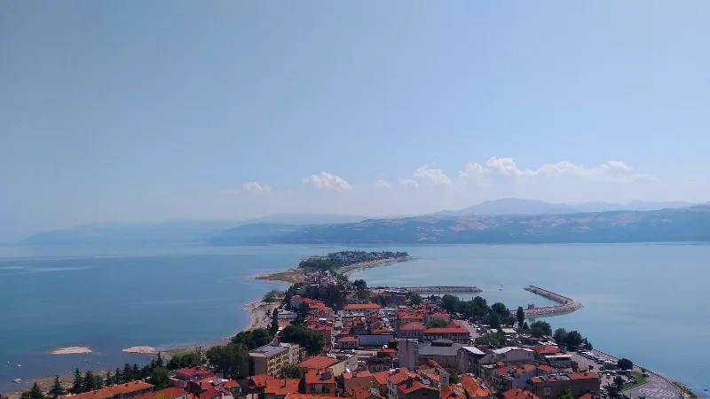
Isparta
Isparta is a city in southwestern Türkiye, renowned for its rose oil production and apple orchards. It serves as a hub for the Lakes Region, with Lake Eğirdir and several natural parks nearby.
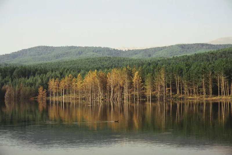
Lake Kovada
Lake Kovada is a small freshwater lake in Isparta Province, Turkey, forming the core of Kovada Lake National Park. Surrounded by pine forests, it is known for its clear water and rich wildlife.
Isparta Rose Gardens and Rose Oil Distillation
The rose gardens around Isparta supply the Damask petals from which one of the world's most precious essential oils is drawn, using copper stills and methods passed down through generations of local families.
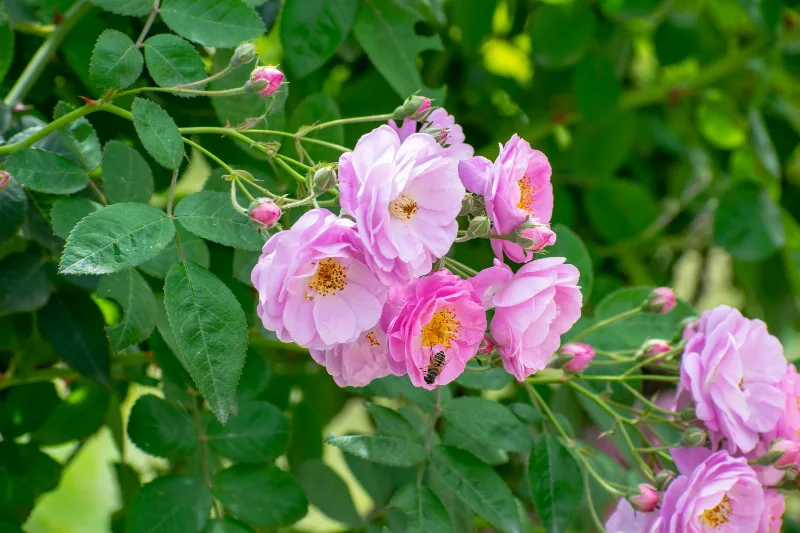
İsparta Roses
İsparta roses are the Damask rose grown around Isparta in southwestern Türkiye, where a dry, high-altitude climate and snow-fed soils give the flowers enough essential oil to support a long-standing rose oil and rose water industry.
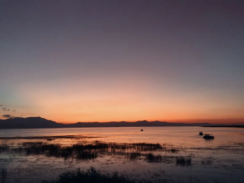
Lake Beyşehir
Lake Beyşehir is the largest freshwater lake in Turkey, set in a tectonic basin between Konya and Isparta and framed by the Sultan Mountains. Its scale, fresh water and protected status make it one of the defining landscapes of the Lake District.

The Rose Harvest in Isparta
Every spring the gardens around Isparta in Türkiye blush with Damask roses, and the picking begins long before dawn. It is a season of pink fields, copper stills and a fragrance that follows you through the streets.