
Diyarbakır City Walls and Hevsel Gardens
A basalt fortress encircles the old city of Diyarbakır, while a fertile belt of market gardens runs down to the Tigris below its towers. Together they form a landscape shaped by centuries of farming and defence.
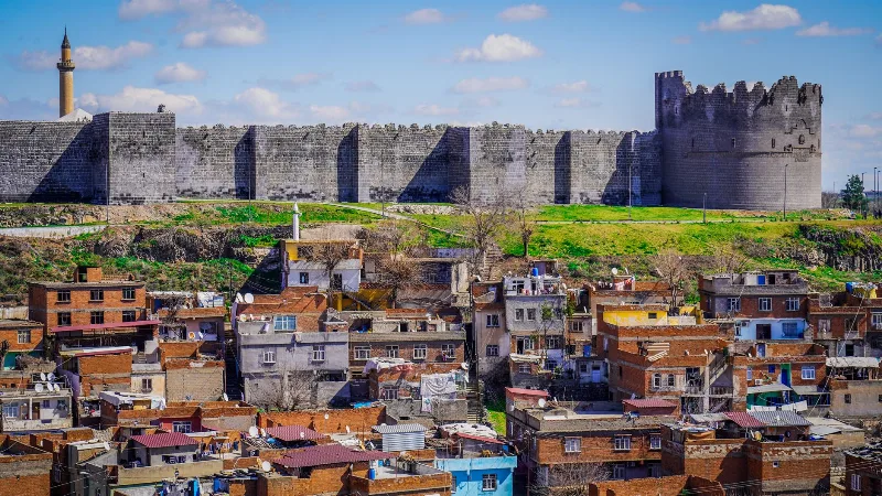
On the wide plain of the upper Tigris basin in south-eastern Türkiye stands the old city of Diyarbakır, wrapped in a ring of dark basalt. The Diyarbakır city walls run for close to six kilometres around the historic centre, making them among the longest surviving circuits of medieval fortification anywhere. Directly below the southern and eastern stretches of the ramparts, the land falls away into the Hevsel Gardens, a broad green belt of orchards and vegetable plots that reaches down to the river. Walls and gardens are closely linked: the fortress needed feeding, and the gardens needed protecting.
A Fortress Built from Black Basalt
The dark volcanic stone that gives the city its character comes from quarries in the surrounding lava plateau. Because basalt is hard and dense, it was used for far more than the defences. Mosques, caravanserais, hans, churches and courtyard houses throughout the old city are built from the same material, so that the settlement reads almost as a single piece of dark masonry.
The defences themselves have been repaired, extended and rebuilt many times. The site has been occupied since antiquity, when the settlement was known as Amida, and the ramparts carry traces of Roman, Byzantine, Artuqid, Aq Qoyunlu and Ottoman work. The walls are several metres thick in places and rise to the height of a small building, following the outline of the ridge rather than a geometric plan.
Towers, Gates and Inscriptions
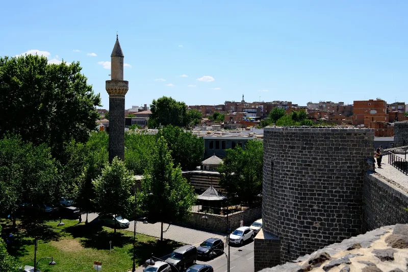
More than eighty towers punctuate the circuit, some square, some round, some polygonal, each with its own proportions and decorative details. Four principal gates pierce the walls and still carry local names linked to the roads they once served, leading out towards the mountains, the plains to the west and the routes to the south.
What makes the walls unusually rewarding to study is the quantity of carved stonework set into them. Reliefs, symbols and inscriptions in several scripts and languages survive on the towers and gateways, left by successive rulers and craftsmen. Some commemorate building works, others record titles and dates. Walking the circuit reveals how each period added its own layer without erasing what came before.
The Hevsel Gardens Below the Walls
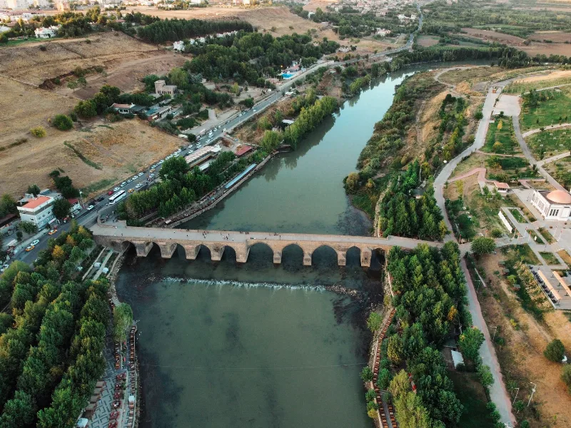
Between the ramparts and the Tigris lies the Hevsel Gardens, a cultivated area of roughly seven hundred hectares. The ground is flat and well watered, fed by springs at the foot of the ridge as well as by the river itself. Narrow channels, small wells and low stone walls divide the land into plots that have been worked for a very long time; the gardens are thought to have supplied the city continuously for many centuries.
Because the soil is alluvial and the water constant, the gardens produce an unusual variety. Vegetables such as aubergines, peppers, tomatoes and leafy greens grow alongside fruit trees, vines and mulberries, while taller poplars are planted along the boundaries. Much of the produce has traditionally been sold in the markets of the old city, and the gardens remain working land rather than a park.
Water, Orchards and Wildlife
The combination of river, irrigation channels and dense cultivation creates a green corridor of real ecological value. The canopy of fruit and poplar trees shelters birds, insects and small mammals, and the damp margins of the channels support amphibians and a range of waterside plants. The Tigris itself carries fish and provides a route for migrating species, while the wooded plots offer shade and nesting places in an otherwise dry landscape.
The gardens also temper the climate of the city above. In summer the irrigated ground stays noticeably cooler than the surrounding plateau, and the green expanse is visible from the towers as a striking contrast with the black stone.
A Landscape Shared by People and Nature
Taken together, the fortress and the gardens were recognised as a World Heritage cultural landscape, an acknowledgement that neither element makes sense alone. The walls defended a settlement that depended on the fields beneath them, and the fields survived because the settlement endured. For visitors, the pleasure lies in the pairing: climbing to a tower for the long view over the orchards, then descending to walk the shaded paths where the produce of the plain has been grown for generation after generation. It is a place where the practical business of farming and the monumental business of defence have shaped one another for well over a thousand years.
Related content
Diyarbakır
Diyarbakır is a major city in southeastern Türkiye, set on the upper Tigris River and encircled by one of the world's longest surviving circuits of ancient walls. Its black basalt architecture and Kurdish cultural identity distinguish it within the region.
Nature
Lakes, forests, rivers, canyons, mountains, wetlands and national parks across Türkiye.
Diyarbakır's Historic Walls
The black basalt ramparts of Diyarbakır in southeastern Türkiye enclose a historic old town and overlook the Tigris River and the Hevsel Gardens. Their gates, towers and inscriptions record centuries of Anatolian and Mesopotamian history.
5-Day Tigris and Euphrates Route
A five-day, east-to-west journey across Southeastern Anatolia from Diyarbakır to Gaziantep, following the Tigris and Euphrates through Mardin, Şanlıurfa, Göbeklitepe and Harran.
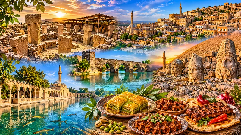
Southeastern Anatolia Region
Southeastern Anatolia is known for its ancient cities, extraordinary archaeological heritage, traditional stone architecture and rich culinary culture. From the historic streets of Mardin to the monumental landscapes of Şanlıurfa and the Euphrates River, the region reflects thousands of years of civilization.
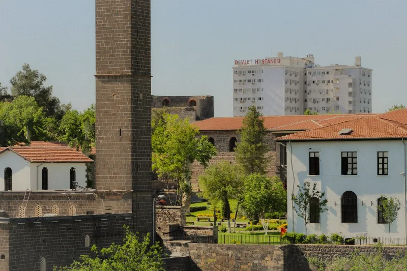
The Historic City Walls of Diyarbakır
Explore the ancient city walls of Diyarbakır, a UNESCO World Heritage Site, renowned for their historical significance and architectural grandeur.
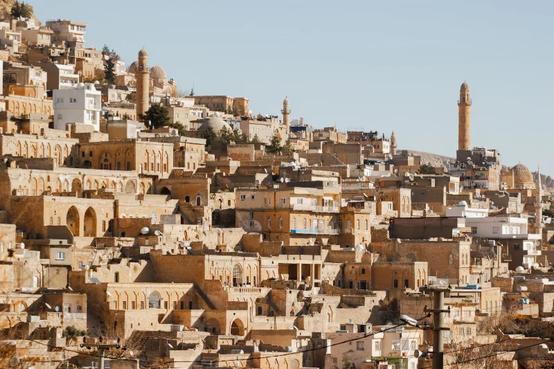
Mardin
Mardin is a historic city in southeastern Türkiye, built on a rocky hillside above the Mesopotamian plain and known for its honey-coloured stone architecture and Syriac Christian heritage.
Hazar Lake and Sunken City in Elazığ
Hazar Lake is a large tectonic lake south-east of Elazığ in Eastern Anatolia, known for its clear water and for the submerged remains of an older settlement that lie beneath its surface.