
Uçhisar
Uçhisar is a small town in the Nevşehir province of Cappadocia, built around a huge volcanic rock fortress that rises above the surrounding valleys and fairy chimneys.
Uçhisar is a small town in the Cappadocia region of central Türkiye, within the province of Nevşehir. Its defining feature is a massive rock outcrop that dominates the settlement — a natural volcanic formation that has been hollowed out over centuries and is widely known as Uçhisar Castle. From its summit, the town looks out across a wide volcanic landscape of fairy chimneys, carved valleys and distant ridges, which is why the place is closely associated with the panoramic views of Cappadocia.
Where Uçhisar Is and How It Sits in the Landscape
Uçhisar lies in the Cappadocia plateau, a region shaped by ancient volcanic activity and later eroded by wind and water into soft tuff rock. The town sits on and around a rocky hill, and the highest point of the settlement is the castle rock itself. Because the terrain rises sharply, the town is laid out in terraces and slopes rather than on flat ground. Streets bend around the rock, often climbing or descending, and many buildings are cut directly into the stone or built from local volcanic blocks.
Geographically, Uçhisar is positioned close to other well-known Cappadocian settlements. Göreme lies to the north, Ortahisar to the east, and the town of Nevşehir is to the northeast. This central position makes Uçhisar a natural reference point for understanding the layout of the region.
The Castle Rock and Its Role in the Town
The rock outcrop known as Uçhisar Castle is the reason the town exists in its current form. It is not a castle in the classic European sense of a built fortress with walls and towers. Instead, it is a natural rock formation that people carved into, creating rooms, passages and storage spaces inside it. Over time, the rock became a defensive refuge and a lookout point.
Several of the inner spaces are carved chambers, and some sections show the marks of long-term human use. The top of the rock offers a wide view over the surrounding area. On clear days, this view takes in the fairy chimneys of the nearby valleys, the town itself, and the broader Cappadocian plateau. The rock is the single most distinctive physical landmark of Uçhisar, and it is what separates the town from other settlements in the region.
What Makes Uçhisar Distinctive
Many towns in Cappadocia have rock formations and cave dwellings, but Uçhisar is unusual because its identity is tied so completely to one single, very large rock. The town is not simply near the rock; it is arranged around and partly inside it. The castle rock is visible from most parts of the settlement, and the town's streets tend to orient toward it.
Another distinguishing feature is the mix of inhabited and abandoned structures. Some houses are still in use, while others stand empty, with their carved windows and doorways open to the weather. This combination of a living town and older, partly abandoned cave architecture gives Uçhisar a specific character that is different from the more heavily visited valley settlements nearby.
Village and Town Character
Uçhisar is small enough to walk across in a relatively short time, but its uneven ground means that a walk involves constant changes in elevation. The settlement feels quiet outside the busier periods of the day. Local life is tied to the landscape: agriculture, small-scale crafts, and, more recently, visitors who come to see the rock and the surrounding valleys.
The town center has a compact, lived-in feel, with narrow lanes and low stone buildings. Away from the center, the streets become steeper and more irregular as they approach the rock. There are open patches where the surrounding countryside becomes visible between buildings.
Traditional Architecture
Uçhisar's architecture is shaped by the soft volcanic stone around it. Buildings are commonly made from locally quarried tuff blocks, which are light in colour and relatively easy to cut. Many structures have flat roofs, small windows and simple, thick walls that help keep interiors cool in summer and warmer in winter.
Carved cave dwellings are also part of the town's built environment. These are rooms cut into the rock face, sometimes with carved doorways, niches and storage areas. Some carved spaces have been adapted for modern use, while others remain unused. The result is a town where natural rock and constructed buildings blend into one continuous surface.
Streets, Slopes and Walking Conditions
The streets of Uçhisar are not arranged on a grid. They follow the shape of the hill, twisting between houses and rock faces. Many are paved but narrow, and some are stepped. Walking through the town requires attention to the ground, because slopes are steep in places and surfaces can be uneven.
Comfortable shoes are useful, and anyone with limited mobility should expect certain parts of the town, especially the climb toward the castle rock, to be difficult. The reward for the climb is a series of changing views over the rooftops, the carved facades and the valleys beyond.
History and Cultural Background
Uçhisar's history is closely connected to the wider history of Cappadocia. The region has been inhabited for a very long time, and its soft rock made it possible for communities to carve out dwellings, churches and storage areas. The castle rock served as a natural strong point, and the settlement around it developed as a place where people could live close to a defensible high point.
Over the centuries, Cappadocia's population shifted several times, and many cave settlements were abandoned as people moved to more conventional houses. Uçhisar reflects this process: it retains carved architecture while continuing to function as an ordinary small town rather than an open-air museum.
What You Can See While Walking Around
A walk through Uçhisar usually begins in the lower part of the town and works upward. Visitors can see carved cave dwellings, stone houses with traditional details, and small squares where the local layout becomes clear. The climb toward the castle rock passes close to carved rooms and openings in the rock face.
From the top, the view extends over the surrounding valleys and their fairy chimneys — tall, thin cones of rock capped with harder stone. These formations are the result of erosion acting on layers of volcanic material, and they appear across the Cappadocian landscape. Uçhisar's elevated position makes them easy to see in a single sweep.
How to Reach Uçhisar
Uçhisar is reached by road from Nevşehir, which is the provincial centre and has the closest airport serving the Cappadocia area. From Nevşehir, the drive to Uçhisar is short because the town lies just to the southwest. Göreme and Ortahisar are also close by road, and the routes between these settlements are well established.
Because the towns of Cappadocia are spread across a relatively compact area, Uçhisar is often used as a base for exploring the region. Local road connections make it possible to move between Uçhisar, Göreme, Ortahisar and Nevşehir without long journeys.
When to Visit
Cappadocia has a continental climate with hot, dry summers and cold winters. Spring and autumn are generally the most comfortable periods for walking, because temperatures are moderate and the ground is easier to negotiate. Summer can be very warm, particularly on exposed slopes, so early morning and late afternoon are often better for climbing toward the rock.
Winter brings cold conditions and the possibility of snow. Snow on the volcanic rock and fairy chimneys changes the appearance of the landscape considerably, but it also makes paths slippery and some routes less accessible.
Practical Information Before Visiting
Uçhisar rewards slow exploration rather than a quick stop. Because the town is built on a slope, allowing extra time for walking is sensible. Water and sun protection are useful in the warmer months, since much of the terrain is exposed. It is also worth remembering that many of the carved spaces are fragile and that some are private property or unsafe to enter.
There is no need to plan every detail in advance; the town is compact enough to explore on foot once you arrive. What matters most is understanding that Uçhisar's interest comes from the combination of its rock, its carved architecture and its position above the surrounding valleys.
Nearby Places
Several settlements in Cappadocia lie close to Uçhisar and share its geological setting. Göreme, to the north, is known for its carved churches and rock formations. Ortahisar, to the east, also has a prominent rock outcrop at its centre, though it is smaller than Uçhisar's. Nevşehir, to the northeast, is the main urban centre of the province.
The valleys around Uçhisar are part of the same eroded volcanic landscape, so walking routes in the area often connect the town with neighbouring settlements. Together, these places form a network of small towns and villages set within one of the most distinctive geological areas in Türkiye.
From the land
Find All →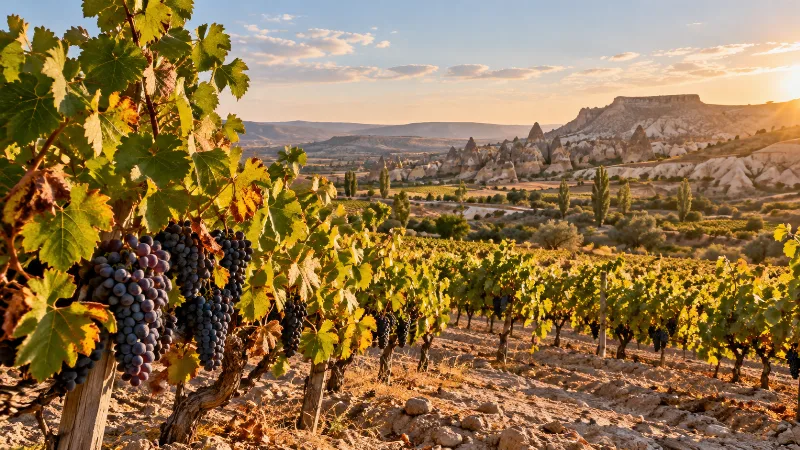
Nevşehir Grapes
Nevşehir grapes come from the volcanic plateau of Cappadocia in central Türkiye, where thin tuff soils, high elevation and dry summers support vineyards grown for wine, grape molasses and drying.
Explore →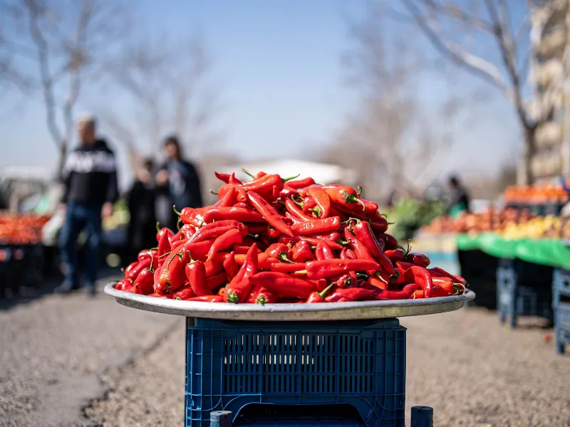
Kahramanmaraş Peppers
Kahramanmaraş peppers are the red peppers grown on the inland plains of southern Türkiye, where hot, dry summers and fertile soils give the crop its deep colour, moderate heat and smoky aroma.
Explore →
Datça Almonds
Datça almonds are the almonds grown on the Datça peninsula in Muğla province, southwestern Türkiye, where mild Mediterranean winters, sea air and rocky, well-drained slopes have shaped a local almond-growing tradition centred on sweet, firm kernels.
Explore →Related content
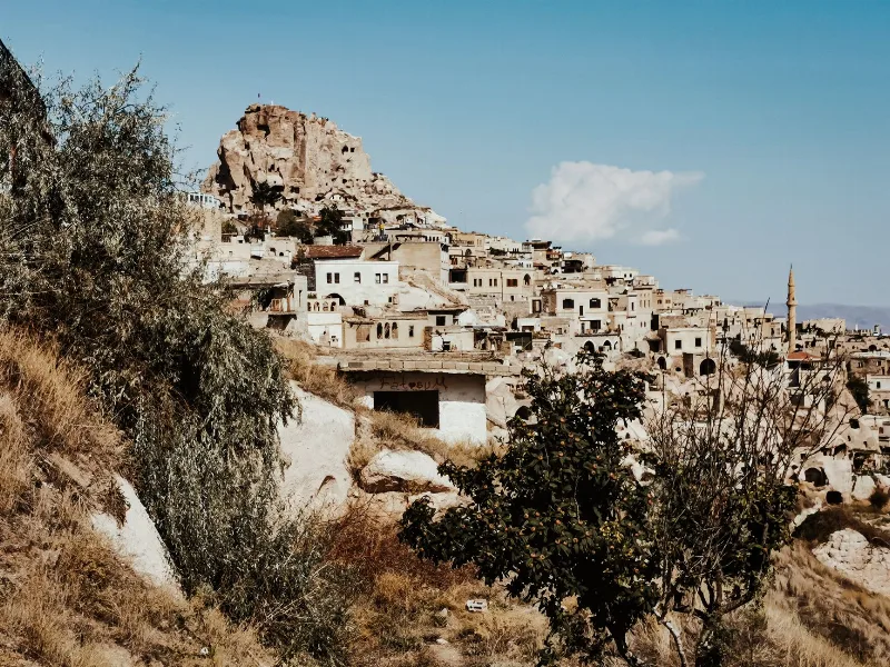
Nevşehir
Nevşehir is a provincial capital in Central Anatolia and the main urban base for the rock landscapes, underground settlements and balloon flights of the Cappadocia region.
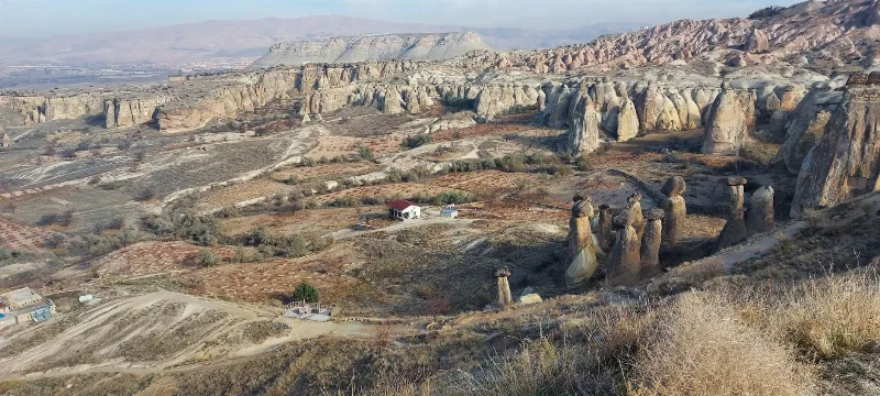
Cappadocia
Cappadocia is a region of Central Anatolia in Turkey defined by eroded volcanic tuff, rock-cut Byzantine churches and multi-level underground cities. This guide explains how the landscape formed, what the main valleys and sites actually contain, and what to know before visiting.
Ortahisar
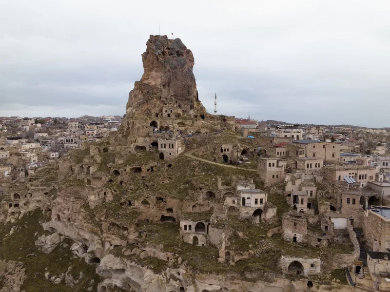
Ortahisar is a small Cappadocian town in Nevşehir Province, built around a massive rock castle and shaped by carved cave houses, stone streets and old storage tunnels.
Grape Harvest in Nevşehir
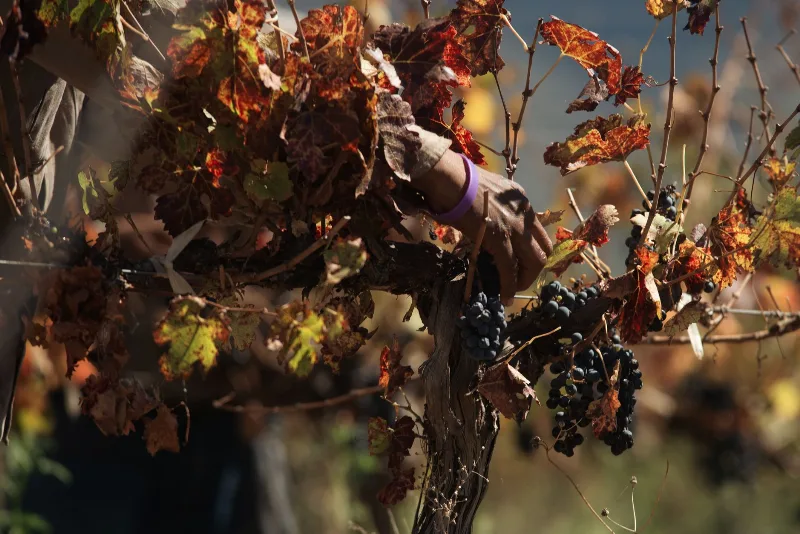
Each autumn the volcanic slopes around Nevşehir turn to grape picking, when families gather fruit for wine and molasses across the Cappadocia vineyards.
Göreme National Park
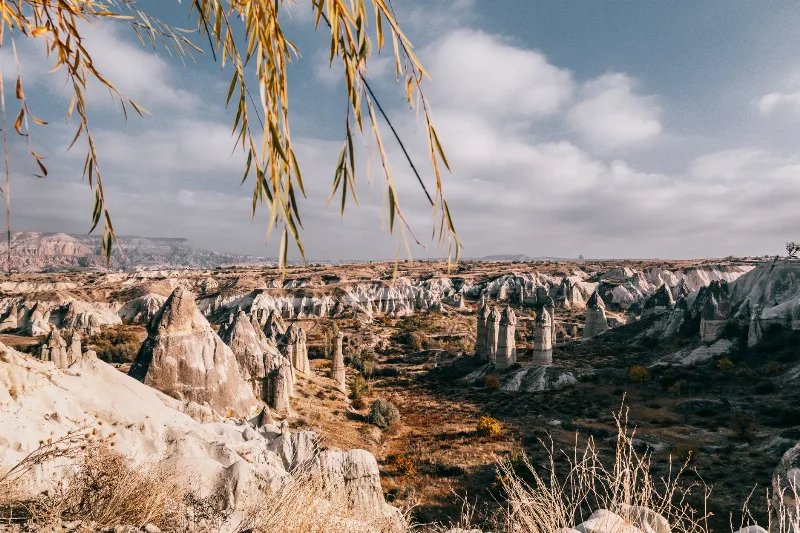
Göreme National Park is a protected volcanic landscape on the Cappadocia plateau in Nevşehir Province, Türkiye, defined by eroded tuff cones known as fairy chimneys and by settlements carved into the same soft rock.
Derinkuyu Underground City
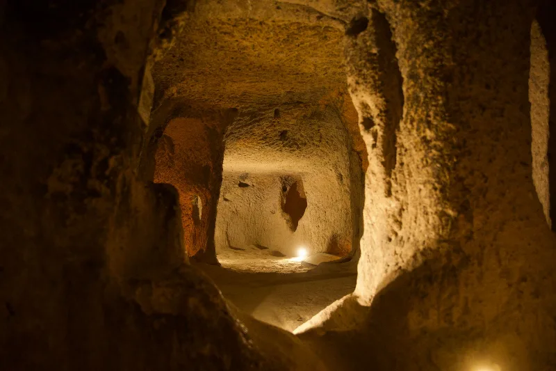
Derinkuyu Underground City is a multi-level rock-cut settlement beneath the town of Derinkuyu in Nevşehir Province, the deepest known underground city in Cappadocia and one of Anatolia's most complete examples of subterranean architecture.