
6-Day Mediterranean Coast Route: Antalya to Marmaris
A six-day linear route along Türkiye's Mediterranean coast, linking Antalya, Olympos, Demre, Kekova, Kaş, Kalkan, Patara, Fethiye and Dalyan before finishing in Marmaris. It mixes ancient cities, long beaches and small harbour towns on a continuous westward drive.
This six-day route follows the Mediterranean coast of Türkiye from Antalya in the east to Marmaris in the west, tracing the Turkish Riviera and the historic Lycian shore. It moves through Kemer, Olympos, Demre, Kaş, Kalkan, Patara, Fethiye and Dalyan, gathering ancient cities, long beaches, sheltered bays and small harbour towns into one continuous westward journey. The route is linear rather than circular: the coast road generally runs east to west, so it makes most sense to start in Antalya and finish in Marmaris. It works best with a car, and each day combines driving with walking at archaeological sites, on beaches and through old town centres.
Day 1: Antalya to Çıralı and Olympos
Start in Antalya, where the old harbour quarter of Kaleiçi, the cliffs above the gulf and the wide sweep of the city's coastline give a clear sense of the geography you are about to follow. Leave the city heading west through Kemer, with pine-covered mountains on one side and the sea on the other. The first substantial stop is Phaselis, an ancient port city set on a small peninsula with three harbours, a colonnaded street and sandy coves. It is an easy introduction to this coast's habit of placing ruins directly beside swimming water, and it belongs among TürkiyeKart's Historic Places.
Continue west to the Olympos valley, where a stream runs through the remains of another ancient city, a short distance inland from Çıralı beach. The valley is shaded and cool, while the beach beyond it is long, pebbly and backed by mountains. In the late afternoon, walk up to Yanartaş, the Chimaera, where gas escaping from the hillside has burned continuously for centuries. Plan the climb so you descend while there is still daylight. Overnight in Çıralı or Olympos; both the ruins and the beach appear in TürkiyeKart's Historic Places and Beaches & Bays sections.
Day 2: Çıralı to Demre and Kekova
Head west past Finike, a stretch where citrus groves and pomegranate orchards line the road and mark the transition from the Antalya coast into the Demre plain. Demre is the day's historic centrepiece. The ancient city of Myra has rock-cut tombs carved high into the cliff face and a large Roman theatre below them, while the Church of St Nicholas stands closer to the town. A short distance away, the harbour of Andriake preserves a substantial Roman granary beside the water.
In the afternoon, continue to Üçağız or Kale (Simena), the small settlements that face the Kekova channel. Boat trips run across to the partly submerged ruins of the sunken city, with the half-flooded walls and foundations visible just below the surface. Because the area is protected, swimming and diving are restricted around the submerged remains, while the surrounding bays are open for swimming. This is genuinely a boat day rather than a driving day, and trips depend on sea conditions. Overnight in Demre, Üçağız or Kale.
Day 3: Demre to Kaş
The road climbs away from Demre and follows the coast west, giving repeated views back over the Kekova region and out to the islands offshore. Continue along the shoreline into the Kaş peninsula, a landscape of rocky slopes, small coves and terraced hillsides. Kaş itself is a compact harbour town of narrow streets and whitewashed buildings, covered as a district in TürkiyeKart's Cities & Districts section.
In Kaş, the Hellenistic theatre of Antiphellos faces the sea just above the town, and Lycian rock tombs are cut into the slope above the streets. The peninsula to the west, around Çukurbağ and Limanağzı, offers quieter swimming spots away from the centre. Kaş is a good place to slow down, since the next day involves the longest driving stretch of the route. Overnight in Kaş.
Day 4: Kaş to Fethiye
Leave Kaş heading west and stop at Kaputaş, a small sandy beach set in a steep gorge where a stream meets the sea. Continue to Kalkan, where houses climb the hillside above a curved harbour, then follow the coast to Patara. Patara combines one of the longest sandy beaches on the Mediterranean with a substantial ancient city behind the dunes, entered past a Roman triumphal arch, and the nearby sites of Xanthos and Letoon lie slightly inland in the Xanthos valley.
From there the route turns inland into the mountains to Saklıkent, a deep and narrow gorge cut by cold meltwater, and then to Tlos, an ancient city on a rocky ridge above the valley. The final section descends toward Fethiye and its sheltered gulf. This is the most demanding day in terms of distance and variety, so travellers who prefer a gentler pace can drop the inland detours and drive directly to Fethiye. Overnight in Fethiye.
Day 5: Fethiye, Ölüdeniz, Göcek and Dalyan
Begin the day just south of Fethiye at Kayaköy, an abandoned village of stone houses and chapels on the hillside, then continue to Ölüdeniz, where a lagoon is separated from the open sea by a narrow spit of sand. Ölüdeniz and the surrounding bays sit in TürkiyeKart's Beaches & Bays section, and the wider Fethiye area also appears under Nature for its forested mountains and coastline.
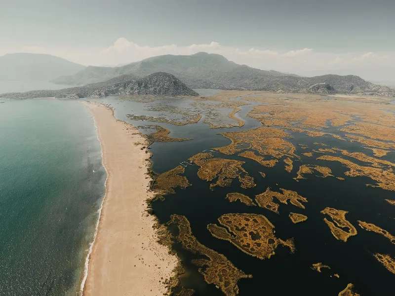
Return through Fethiye and head northwest along the gulf to Göcek, a small town set among pine-covered islands and sheltered anchorages. Continue over the hills to Dalyan, a river settlement where the day finishes. In the late afternoon, take a boat along the Dalyan river to İztuzu beach, a long sandbar that is an important nesting area for loggerhead turtles, or visit by road. Across the river from Dalyan, the ruins of Kaunos include rock tombs cut into the cliff face that are visible from the town itself. Overnight in Dalyan.
Day 6: Dalyan to Marmaris
Spend the morning in and around Dalyan, then continue west past Köyceğiz lake, where the road runs between the water and forested hills before climbing over the ridge toward the coast. The route descends into Marmaris, a large harbour town with a castle overlooking the bay, a busy old quarter behind the waterfront and a long curving beach. The Bozburun peninsula to the south, including Turunç and the villages along its coast, offers a quieter final swim before the journey ends.
Marmaris is the natural finishing point because it marks the western end of this coastal corridor, and onward sea connections to the wider Aegean exist from the harbour. The six-day route ends here, with the whole Lycian and western Mediterranean coast behind you.
Best Season and Travel Conditions
Spring and autumn are the most comfortable periods for this route. Midsummer brings high heat, crowded beaches and heavy traffic between the main resorts, while winter can be wet and quiet, with some boat services reduced. The coastal road includes long stretches of winding mountain driving, especially between Demre and Kaş and between Fethiye and Dalyan, so progress is slower than the map suggests. Walking is required at Olympos, Phaselis, Myra, Kaunos and most of the other archaeological stops, and sturdy shoes are useful at Yanartaş and Saklıkent.
How to Approach the Route
A car gives the most flexibility, particularly for the inland detours on Day 4. Long-distance buses link the main coastal towns along the Antalya–Fethiye–Marmaris corridor, which makes a car-free version possible if you accept less freedom at the smaller stops. Boats are required or strongly preferable at Kekova and for reaching İztuzu beach from Dalyan. Because the route is linear and long, travellers short on time should treat the sequence as a spine rather than a fixed schedule: skipping one or two stops keeps the journey realistic, while adding days makes it far more relaxed.
Remarkable Places
See all places →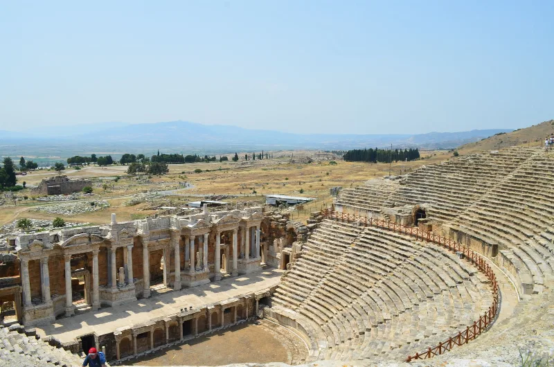
Letoon
Letoon is a Lycian sanctuary near Xanthos in Muğla Province, dedicated to Leto, Artemis and Apollo. Its three temples, theatre and trilingual inscription make it one of southwestern Turkey’s most significant archaeological sites.
Explore →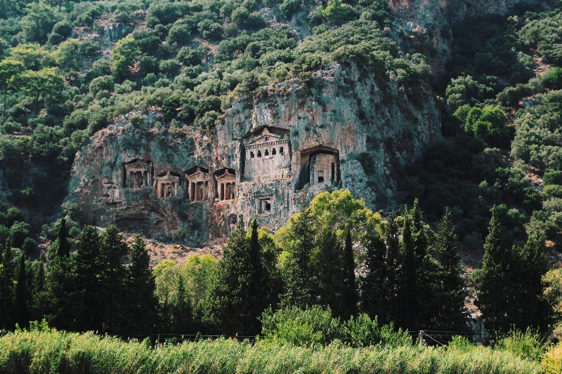
Kaunos
Kaunos is an ancient Carian city on the Dalyan River in Muğla Province, known for its temple-style rock-cut tombs and the extensive ruins of a harbour that silted up centuries ago.
Explore →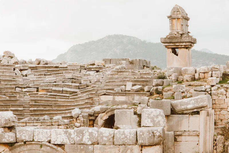
Xanthos
Xanthos is an ancient Lycian city in Antalya Province and a UNESCO World Heritage Site, known for its Lycian tombs, Roman theatre and role as a leading city of Lycia.
Explore →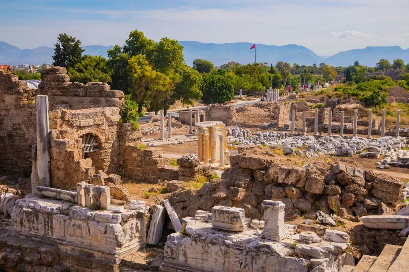
Phaselis
Phaselis is a Rhodian-founded port city on the eastern Lycian coast, where paved streets, agoras, baths and a small theatre stand among pines between three sheltered bays.
Explore →Related content
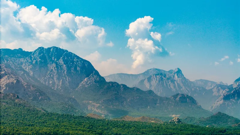
Antalya
Antalya offers a unique blend of vibrant history and stunning natural beauty, making it a must-visit destination in Türkiye.
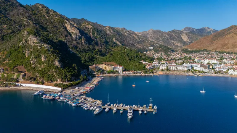
Marmaris
Marmaris is a dynamic port city on the Turquoise Coast, known for its vibrant marinas and lively nightlife, offering scenic harbor views.
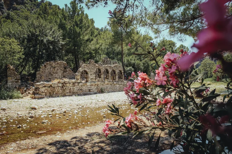
Olympos
Olympos is an ancient Lycian city in Antalya Province, Türkiye, whose ruins stand on both banks of a wooded river valley. Once a member of the Lycian League and later a Roman harbour town, it is best known for its theatre, baths and Lycian sarcophagi, and for the naturally burning Chimaera flames on the mountain above.
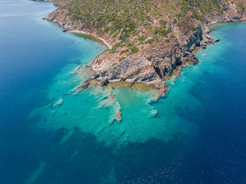
Sailing the Turquoise Coast
The Turquoise Coast follows the southwestern shoreline of Türkiye, where sheltered bays, pine hills and clear water meet. This page explores how sailing and boat trips reveal its landscapes, islands and ancient harbours.
4-Day Marmaris and Dalyan Route
A four-day linear route that starts in Marmaris, crosses the Gulf of Gökova and Lake Köyceğiz, and ends around the river, rock tombs and turtle beach of Dalyan.
Routes
Road trips, coastal drives, cultural routes and scenic journeys across Türkiye.