
Derinkuyu Underground City
Derinkuyu is a multi-level city carved into the volcanic rock of Cappadocia, deep enough and large enough to have sheltered thousands of people and their animals underground. This guide explains its structure, history and what a visit actually involves.
Derinkuyu Underground City is a hand-carved subterranean settlement cut into the soft volcanic rock beneath the town of Derinkuyu, in Nevşehir Province, within the Cappadocia region of central Türkiye. It is the deepest of the region's known underground complexes, descending roughly 85 metres below the surface through a stack of levels connected by narrow stairways and shafts. Its scale is the reason it is famous: the carved chambers, storerooms and animal pens were built to hold thousands of people, together with their livestock and food reserves, for long periods below ground. The site takes its name from the modern district above it — "derin kuyu" means "deep well" in Turkish — and the town's own water needs and the city's hidden depths have been linked in local usage for generations.
Where Derinkuyu Sits in the Landscape
The underground city lies under the centre of Derinkuyu, a district on the flat, high plateau south of Nevşehir, roughly halfway along the road that runs from Nevşehir towards Niğde. This is a wide, open tableland at around 1,300 metres of elevation, ringed by low volcanic hills and cut by shallow valleys. It is not the fairy-chimney landscape of Göreme; the terrain here is broad and agricultural, with fields and scattered villages. That difference matters, because it explains why the entrances to such an extensive underground complex remained unnoticed for so long. There are no dramatic surface rock formations above Derinkuyu, only houses, courtyards and a modest rise in the ground. The city is entirely inside the rock, accessed through doorways in ordinary-looking buildings.
Why the City Was Built and Why It Matters
Cappadocia was repeatedly crossed by armies and raided over the centuries, and its inhabitants had few natural defences on such open ground. The solution was to disappear. Underground settlements allowed entire communities, along with their animals and stores, to withdraw behind heavy stone doors and wait out a threat that could not reach them. Derinkuyu is the largest and most elaborate surviving example of this defensive way of living. It is not simply a cave or a cellar but a functioning town turned inward: places to keep animals, to store grain and wine, to cook, to worship and to bury the dead, all arranged vertically and protected by a single narrow approach route that could be sealed at several points. For anyone interested in how ordinary people survived in a contested region, Derinkuyu is one of the most complete answers that exists.
How the Rock Made It Possible
The whole complex exists because of geology. The plateau is covered in thick layers of tuff, a soft rock formed from ash and debris thrown out by the region's volcanoes, including Erciyes and Hasan Dağı, and later compacted. Fresh tuff is easy to cut with simple iron tools, which is why generations of inhabitants could hollow out rooms without machinery, while the exposed surfaces harden and dry once air reaches them. The rock is also stable enough to hold large unsupported chambers and long stairwells. This combination — soft to carve, firm once cut, and insulating against both summer heat and winter cold — is what turned the Cappadocian plateau into a landscape of underground dwellings, of which Derinkuyu is the deepest known example.
Layout and Architecture Below Ground
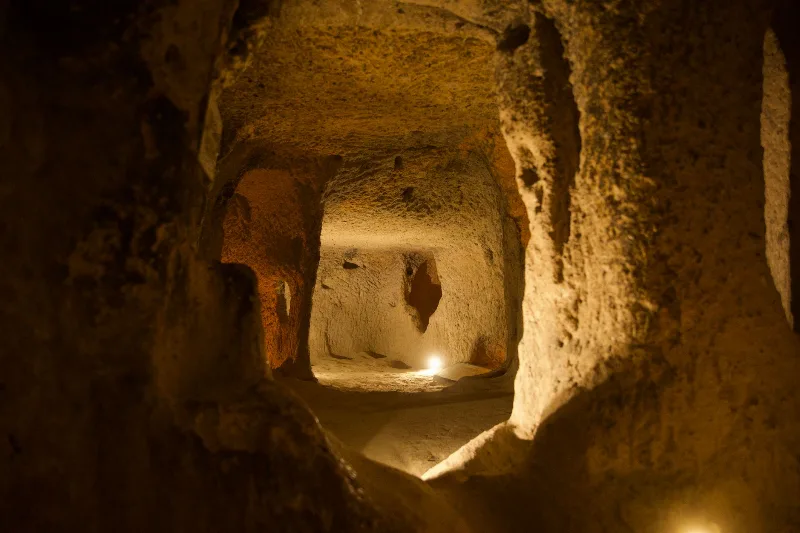
The city is organised as a series of levels, each roughly a floor, connected by vertical shafts and cramped stone stairs. Passageways are deliberately low and narrow, forcing visitors to stoop and move in single file, which also made them easy to defend. Only part of the total depth is open to the public; the lower levels are not all accessible, and sections of the complex remain closed.
Rolling stone doors
The most distinctive defensive feature is the rolling stone door: a large circular millstone-shaped slab, sometimes close to a metre and a half across, set in a groove in the wall. It could be rolled across a passage to seal it from the inside, and it was designed so that it could not easily be pushed open from the outer side. Several of these doors survive in place along the main route downward, and they are the clearest evidence of how the city was meant to be defended rather than simply occupied.
Ventilation and water
Air movement through a settlement this deep was not accidental. Dozens of ventilation shafts run from the lowest levels to the surface, providing a continuous draught that kept the air breathable far below ground and also allowed some communication between levels. Water was the harder problem, since the city was not built around a spring. Supplies were carried down and stored in cisterns and large jars, and the deep well that gives the town its name is part of the same problem of securing water in a place designed to be cut off from the surface.
What You Actually See Inside
A visit follows a descending route through rooms whose functions are still legible from their shape and fittings. You pass stables and animal pens with carved tethering holes and feeding troughs, storage rooms and granaries, wine presses with channels cut into the floor, kitchens and communal refectory areas with long stone benches and tables. There are living quarters, small niches for oil lamps, and a cruciform church reached near the lowest accessible level, cut with a simple barrel-vaulted ceiling and an apse. The scale becomes clear only gradually: the low corridors open repeatedly into rooms far larger than the passages suggest, and the temperature remains noticeably cool and even throughout the year.
History and Dating
Exact dating is difficult, because the rock was cut, used, extended and re-cut over a very long period and leaves little datable material. The earliest phase is generally associated with the Phrygians in the first millennium BC, and the practice of living in excavated underground dwellings in Anatolia was already known in antiquity. The complex was greatly expanded in the Byzantine period, when Christian communities in Cappadocia used such refuges during periods of insecurity. The city stayed in use, in some form, for centuries afterwards. Its modern rediscovery came in 1963, when a local resident found a passage behind a wall in his house; the site was opened to visitors in 1965. A tunnel is popularly said to link Derinkuyu with the underground city of Kaymaklı some kilometres away, though this has not been fully confirmed.
Visiting Derinkuyu
Derinkuyu is an easy day trip from Nevşehir and is often combined with other Cappadocian sites. The district is served by buses and minibuses on the Nevşehir–Niğde road, and the entrance is in the town itself, so no long walk is required to reach it.
Terrain and accessibility
Inside, conditions are demanding. The route is steep in places, with low ceilings, uneven stone steps, narrow passages and enclosed sections where taller visitors must bend. People with claustrophobia, mobility difficulties, heart or breathing conditions should consider carefully whether to enter, and small children need close supervision. Footwear with grip is advisable, since the carved surfaces are worn smooth and can be slippery. Bringing a light layer is useful, as the interior stays cool even in high summer.
When to go
Cappadocia has cold, snowy winters and hot, dry summers, with the most comfortable conditions in spring and autumn. Because the underground city is enclosed and naturally cool, it offers relief during the hottest part of the day. It is also a popular stop, so the narrow passages become congested at peak times; visiting early in the day or outside the busiest months makes the experience considerably easier. Snow and ice in winter can make the surface entrance areas slippery.
Related Places Nearby
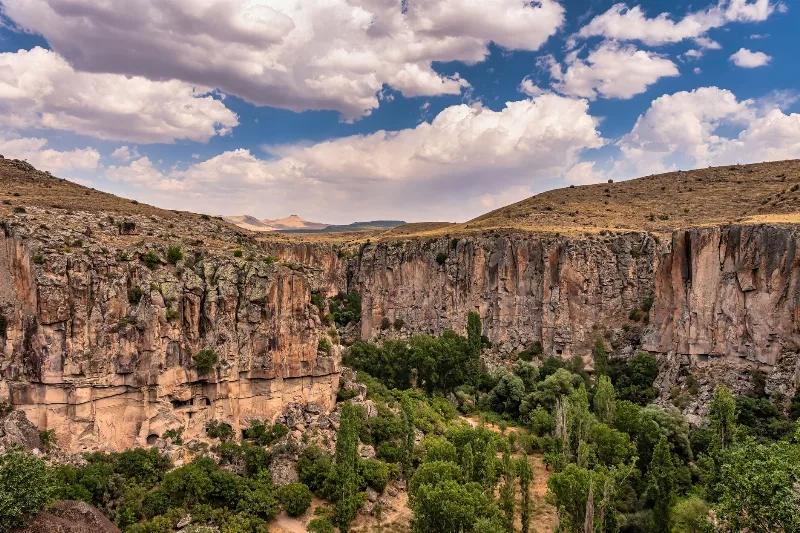
Kaymaklı Underground City, closer to Nevşehir, is the other major subterranean settlement in the region and shares many of the same features, with its own layout and depth. The town of Nevşehir, with its hilltop castle, serves as the main base for the area. Further afield, the rock-cut churches and valleys around Göreme, the Ihlara Valley with its canyon-side churches, and the distinctive landscape of the Soğanlı Valley all belong to the same Cappadocian world of carved rock settlement and worship. Together they show how the region's geology shaped not just its buildings, but the way its people lived.
Related content
Cappadocia
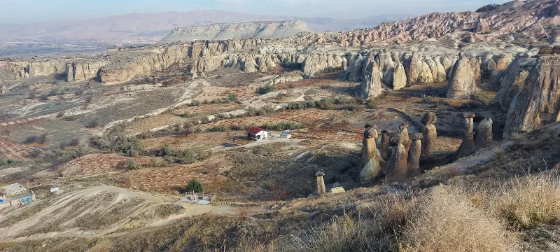
Cappadocia is a region of Central Anatolia in Turkey defined by eroded volcanic tuff, rock-cut Byzantine churches and multi-level underground cities. This guide explains how the landscape formed, what the main valleys and sites actually contain, and what to know before visiting.
Nevşehir
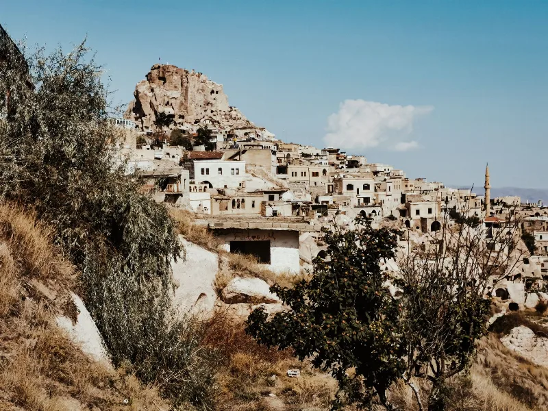
Nevşehir is a provincial capital in Central Anatolia and the main urban base for the rock landscapes, underground settlements and balloon flights of the Cappadocia region.
Kaymaklı Underground City
Kaymaklı Underground City is a multi-level subterranean complex in Nevşehir Province, Cappadocia, used as a refuge by early Christian communities. It features tunnels, stone doors, storage rooms, and churches carved into volcanic tuff.
2-Day Cappadocia Underground Cities Route
A two-day route from Nevşehir through the underground cities of Kaymaklı and Derinkuyu, finishing with a walk through the Ihlara Valley and the rock-cut complex at Selime.
Derinkuyu Underground City
Derinkuyu Underground City is a multi-level rock-cut settlement beneath the town of Derinkuyu in Nevşehir Province, the deepest known underground city in Cappadocia and one of Anatolia's most complete examples of subterranean architecture.
Cappadocia's Underground Cities
Carved by hand into soft volcanic rock, the underground cities of Cappadocia form a network of tunnels, halls and storage rooms that reach several storeys below the surface of central Türkiye.