
Mount Nemrut
Mount Nemrut in Adıyaman Province is the summit hierothesion of King Antiochus I of Commagene, where colossal statues of gods and a royal ruler stand on terraces above an artificial stone tumulus. The site is a UNESCO World Heritage property whose Greek inscriptions and reliefs record a Hellenistic kingdom of the first century BC.
Mount Nemrut is a mountain summit in the Kahta district of Adıyaman Province, in south-eastern Türkiye, crowned by a hierothesion — a combined tomb and sanctuary — created for King Antiochus I Theos of Commagene in the middle decades of the first century BC. The monument consists of a huge mound of crushed stone, two terraces flanking it, and colossal seated statues of deities and of the king himself, accompanied by long Greek inscriptions cut into the rock. Its fusion of Anatolian, Iranian and Greek religious imagery and its remote, high-altitude setting make it one of the most unusual surviving complexes of the Hellenistic period in Anatolia. UNESCO inscribed Nemrut Dağı on the World Heritage List in 1987.
Where Mount Nemrut Stands
The site occupies a summit of roughly 2,150 metres in the Anti-Taurus range, above the valley of the Kahta (ancient Nymphaios) river. The landscape around it is bare, stony and treeless at this altitude, with wide views towards the Euphrates approaches to the east and the mountains of the region in other directions.
The name can cause confusion: there is another, entirely unrelated Mount Nemrut near Lake Van in eastern Türkiye, which is a volcano. The Nemrut discussed here is the archaeological summit in Adıyaman Province, close to the district town of Kahta and the village of Karadut. The two should not be mixed in any route planning.
Commagene: A Small Kingdom Between Great Powers
Commagene was a Hellenistic kingdom centred on Samosata, on the Euphrates. It emerged in the shadow of the collapsing Seleucid state and the expanding Roman Republic, and its rulers claimed descent from both the Persian Achaemenid house and the Seleucid dynasty. That double ancestry is visible in the way Commagenian royal ideology combined Greek and Persian elements rather than choosing between them.
Antiochus I reigned in the first half of the first century BC, in a period when Commagene had to balance between Rome and the Parthian Empire. His father, Mithridates I Callinicus, had already promoted the idea of a royal cult; Antiochus developed it far further, presenting himself as a ruler favoured by, and eventually associated with, a group of deities who were deliberately identified with both Greek and Iranian counterparts.
Why a Sanctuary Was Built on a Mountain Summit
The hierothesion was not a city or a fortress. It was a sacred funerary complex designed to hold the king's tomb, to serve as a place of cult, and to keep his memory and his religious programme visible in a landscape that could be seen from a distance. Building on a bare summit rather than beside a settlement was a deliberate choice: the monument was meant to be conspicuous to the kingdom around it and to stand outside ordinary daily life.
The complex was laid out with a tumulus at its centre, terraces cut into the rocky summit on the eastern and western sides, and processional or ceremonial platforms associated with them. The structure was created as one integrated design rather than assembled over centuries.
The Tumulus and the Search for the Burial Chamber
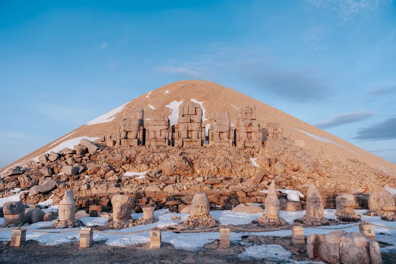
The most prominent element of the site is a conical mound of loose, crushed rock, roughly 50 metres high and about 150 metres across at its base. It is an artificial construction, made of small stones piled over the summit, and it was clearly intended to protect and conceal what lay beneath.
Despite surveys and geophysical investigations, no burial chamber has been located inside the mound, and no royal burial has been recovered from the site. It is generally inferred that the tumulus was intended to cover the tomb of Antiochus I, but the chamber itself has never been found or opened. Statements that the king's grave has been discovered are not supported by the archaeological record.
The Colossal Statues and Who They Represent
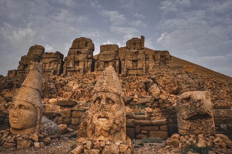
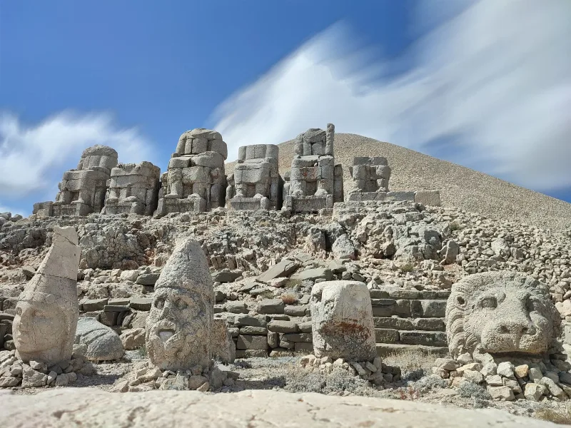
On the terraces stand groups of large seated figures carved from local limestone, originally arranged on thrones, with pairs of guardian animals — eagles and lions — placed at the outer edges. The seated statues are several metres high including their thrones, and the heads alone are around two metres tall.
The figures represent deities in the syncretic form favoured by Antiochus, in which Greek and Iranian names are joined: Zeus with Oromasdes, Apollo with Mithras, Helios and Hermes, and Heracles with Artagnes and Ares. Beside them stood a personification of the Tyche, or Fortune, of Commagene, and a statue of Antiochus I himself, included in the divine assembly as an equal participant in the cult.
The heads of the statues are today separated from their bodies and rest on the terrace floors. Earthquakes in the region, and the natural weakness of the joints between the carved blocks of the necks and torsos, are the main reasons for the collapse; there is also evidence that the figures suffered deliberate damage in later periods, when the site lay abandoned and its pagan imagery was no longer protected.
The East and West Terraces
The eastern terrace is approached from the direction of the summit's easier slope. It holds a group of seated statues, an altar area, and a platform running along the terrace. Because it faces east, it catches the morning light, which is one reason the site is commonly visited early in the day.
The western terrace is larger and contains a more elaborate arrangement, including a broad altar platform and additional statue groups. It faces the setting sun, and in the late afternoon the light falls directly on the figures. Both terraces are cut into the bedrock of the summit, and the edges of the platforms and the recesses behind the statues show how the natural rock was adapted to the design rather than simply built over.
Inscriptions and the Sacred Law
Long Greek texts are carved on the backs of the thrones and on slabs at the site. These inscriptions, often described as a nomos or sacred law, set out Antiochus's religious instructions: they define the cult to be maintained at the hierothesion, name the festivals to be celebrated in connection with his birthday and his accession, and prescribe the duties of the priests who were to serve there.
The texts are among the most important documents for understanding how a Hellenistic ruler presented himself as both a political and a religious figure. They also state the king's intention that the sanctuary should remain permanently in use, an instruction that in practice was not fulfilled after the kingdom lost its independence. Because they are carved on the monument itself, they tie the written programme directly to the physical layout of the terraces and statues.
Reliefs, Dexiosis Scenes and the Lion Horoscope
Alongside the freestanding statues, reliefs were cut into the rock faces of the terraces. Several show a dexiosis — a handclasp between Antiochus and a deity, a gesture expressing welcome, alliance or the reception of the king into the divine sphere. The figures are shown in profile, in a style that combines Greek modelling with strongly Persian details of dress and headgear.
The best known of the reliefs is a large slab carved with a lion, whose body is marked with a group of stars and a crescent moon. Modern astronomical analysis of the configuration has been used to propose a specific date in 62 BC for the celestial pattern shown, and the relief is therefore often described as a horoscope. This dating rests on scholarly interpretation of the star positions and is not a date recorded in any ancient text, so it should be treated as a reasoned hypothesis rather than an established fact.
Decline, Rediscovery and Excavation
Commagene lost its independence in the first century AD, when it was incorporated into the Roman provincial system. With the end of the royal cult, the hierothesion on the summit lost its function. It was left to the weather, to earthquakes and to occasional damage, and over the following centuries its existence faded from wider knowledge, although the summit remained known to people living in the surrounding area.
The site came to international attention in the late nineteenth century, when the German engineer Karl Sester, working on routes in the region, reported the extraordinary statues. This led to an Ottoman expedition the following decade under Osman Hamdi Bey, which produced the first records and drawings of the terraces, statues and inscriptions. German teams returned to work at the site in the twentieth century, documenting the monument and the surrounding Commagenian remains in detail.
What Survives at the Site Today
Visitors reaching the summit see the artificial tumulus, the two rock-cut terraces with their altar platforms, and the fallen heads and torsos of the colossal statues placed where they came to rest. The eagle and lion figures at the edges of the groups also survive, some in better condition than the human figures. The throne inscriptions and the relief panels remain in place on the rock and on the blocks behind and beside the statues.
The overall layout of the sanctuary is still legible: the relationship between the mound, the terraces, the altars and the statue groups can be followed on the ground. What is missing is the royal burial itself, which has never been found, and any trace of the roofed or enclosed structures that may once have sheltered parts of the cult.
Other Commagene Monuments in the Same Area
The Nemrut summit is the most famous part of a wider Commagenian landscape in the Kahta region, and several related monuments lie within reach on the same routes.
- Karakuş Tumulus — a burial mound on a lower ridge, associated with the Commagenian royal family, with tall columns topped by reliefs of an eagle, a lion and a bull.
- Arsameia on the Nymphaios — the site known locally as Eski Kale, near the old town of Kahta, with rock-cut galleries, a large inscription of Antiochus I and a relief showing a handclasp between a ruler and Heracles.
- The Cendere Bridge — a Roman period bridge over the Cendere river, built in connection with the Severan imperial house, showing how the same valley continued to be used for monumental construction long after the Commagenian kingdom ended.
Together these sites make it possible to read Commagene as a landscape of royal monuments rather than a single isolated summit.
Reaching the Area and Visiting Conditions
Access to the region is generally from Adıyaman or from Kahta, from where routes lead up towards the mountain. The final approach to the terraces involves walking on steep, uneven, stony ground; the altitude is considerable, and the surface is loose in places, so sturdy footwear is important. Weather changes quickly at this height, and wind and cold can be significant even when conditions lower down are mild.
The terraces face east and west, so they are lit differently at different times of day; one faces the morning sun and the other the evening light. Late spring through early autumn is the most comfortable period, while winter conditions can make the summit difficult or inaccessible. There are no substantial facilities on the summit itself, and the nearest settlements with services are well below the archaeological area.
A visit is best understood as an archaeological excursion rather than a casual stop: the site rewards time spent reading the inscriptions and reliefs and walking between the two terraces, which together explain how a small Hellenistic kingdom turned a mountain top into a permanently visible statement about its ruler, its gods and its place between the Greek and Persian worlds.
Routes
All routes →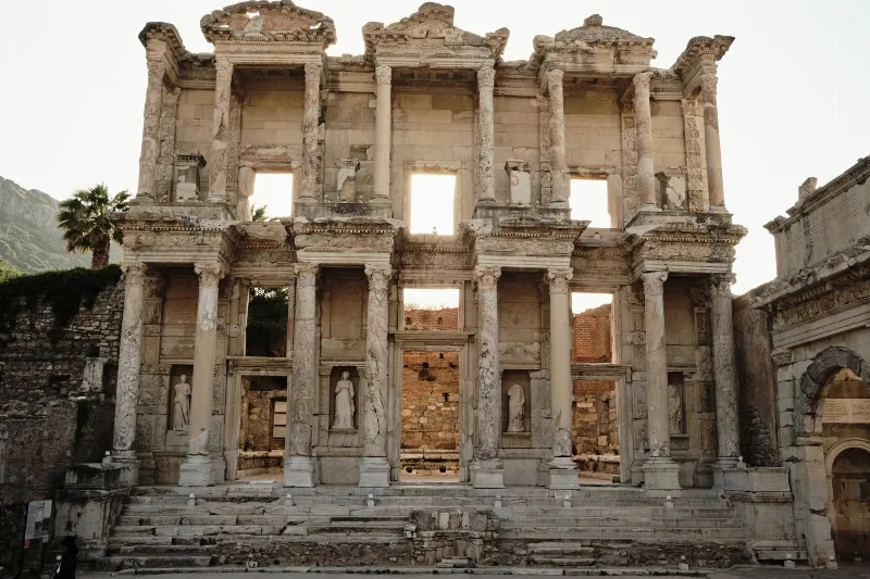
4-Day Ephesus and Pamukkale Route
A four-day west-to-east Aegean route that links the ancient city of Ephesus and the House of Virgin Mary in Selçuk with the white travertine terraces and Hierapolis ruins at Pamukkale, near Denizli.
Explore →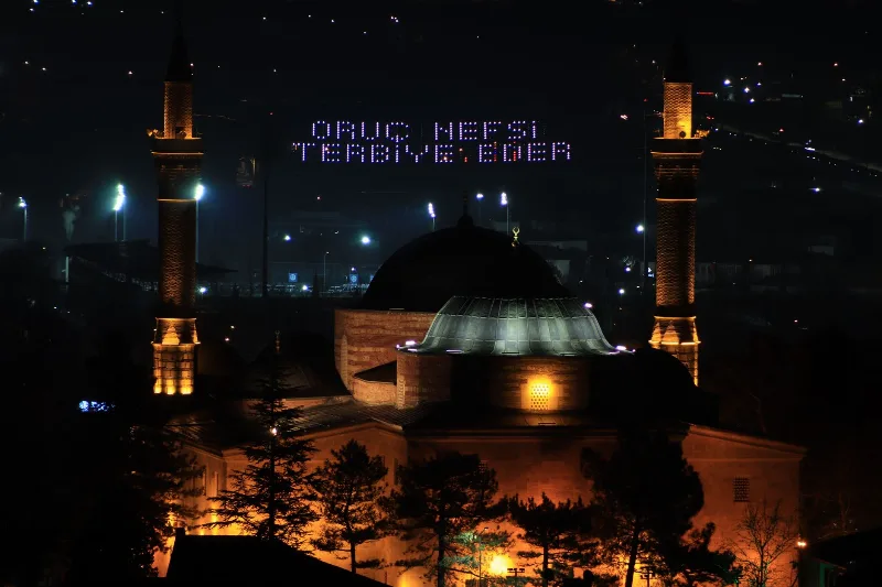
2-Day Bursa and Uludağ Route
A two-day route through Bursa's Ottoman monuments and up to the Uludağ National Park by cable car, combining city walking with mountain hiking or skiing.
Explore →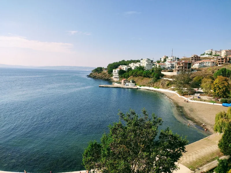
5-Day Black Sea Coast Route
A five-day linear journey along Türkiye's central and eastern Black Sea coast, from Sinop to Trabzon, with an inland detour to Amasya and stops in Ordu and Giresun along the way.
Explore →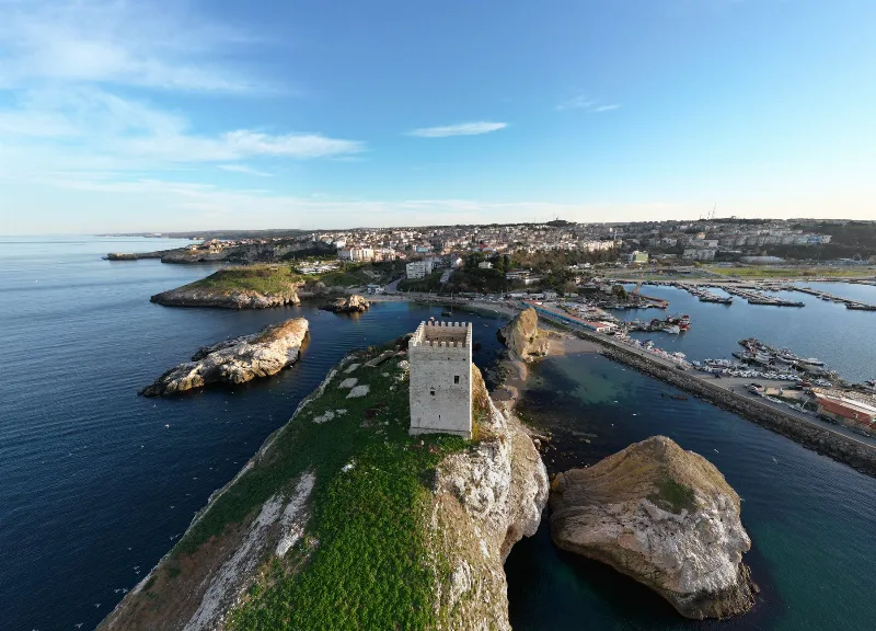
1-Day Sinop Route: Old Town, Castle and Hamsilos Bay
A single-day route through Sinop, from the old harbour and castle walls to the archaeological museum, the historic prison and the wooded bays along the coast west of the city.
Explore →Related content
Nemrut
Mount Nemrut in Adıyaman Province is a 2,134-metre summit crowned by the colossal statues and tomb-sanctuary built by King Antiochus I of Commagene, and it has been a UNESCO World Heritage Site since 1987.
Adıyaman
Explore Adıyaman, southeastern Türkiye: history, standout sights, landscapes, local food and practical travel advice for an unforgettable journey in Türkiye.
Lake Van
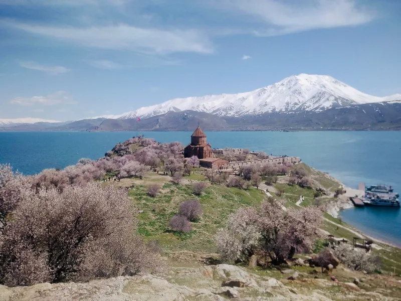
Lake Van is Turkey's largest lake, a vast alkaline soda lake with no outlet, set in the volcanic highlands of Eastern Anatolia at around 1,640 metres. Its unusual chemistry, depth and islands give it a character unlike any other lake in the country.
Mount Nemrut
Mount Nemrut is a dormant volcano in Bitlis Province, eastern Türkiye, featuring a large caldera with crater lakes. It lies west of Lake Van near Tatvan.
Lake Van
Lake Van is Turkey's largest lake and the world's largest soda lake, located in Eastern Anatolia. It is known for Akdamar Island and its 10th-century Armenian Church of the Holy Cross.
Mount Süphan
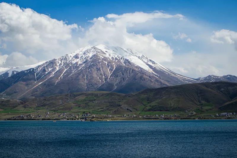
Mount Süphan (Süphan Dağı) is a dormant stratovolcano in Bitlis Province, eastern Türkiye, and the second-highest peak in the country at 4,058 metres, rising above the northern shore of Lake Van.