
Burdur
Burdur is a provincial capital in southwestern Türkiye, set in the inland Lakes District beside a large saline lake and known for the Roman ruins of Sagalassos and one of Anatolia's oldest Neolithic settlements.
Burdur is the capital of Burdur Province in southwestern Türkiye, an inland city of medium size standing at roughly 950 metres above sea level in the area known as the Turkish Lakes District (Göller Yöresi). Although it belongs to the Mediterranean region of the country, it lies well back from the coast, north of Antalya and south of Afyonkarahisar, in a basin ringed by the western Taurus Mountains. What sets Burdur apart from most provincial centres is the combination of its setting: a city built beside a large saline lake, a museum holding finds from one of Anatolia's earliest farming communities, and the nearby Roman city of Sagalassos in the mountains to the south.
A Basin City Between Mountains and Water
Burdur occupies a broad, fertile basin enclosed on several sides by limestone ranges. The modern city spreads across gently sloping ground on the eastern side of Lake Burdur, with the lake forming its western edge. The surrounding plain is used for cereal cultivation, fruit growing and livestock raising, and the countryside between the city and the mountains is dotted with small farming settlements.
The elevation gives Burdur a sharper, drier feel than the coastal cities to the south. Even in summer, evenings are cooler than on the Mediterranean shore, and the light across the basin is clear. The urban layout is compact and functional, with a busy commercial centre, wide avenues in the newer quarters and older streets closer to the middle of town, where traditional Anatolian houses with timber frames, overhanging upper floors and walled courtyards survive in places.
Lake Burdur and the Wetland Landscape
Lake Burdur is the feature that gives the city its identity. It is a large, deep and strongly mineralised lake, high in sodium salts, which makes it alkaline and unsuitable for irrigation or fish farming. Those same conditions make it valuable for wildlife. The lake is recognised as a wetland of international importance and supports significant populations of waterbirds, most notably the white-headed duck, a species for which the site is a key refuge.
Because of its salinity, the shoreline is largely bare, with pale mineral crusts rather than beaches, and the water is not used for swimming. The lake is best understood as a natural and scientific landscape rather than a recreational one. Several smaller lakes and marshy areas lie elsewhere in the province, giving the wider region its name.
From Hacılar to Sagalassos: the Historical Layer
The Burdur area has been settled for an unusually long time. The mound of Hacılar, close to the city, is one of the earliest known farming settlements in Anatolia and produced painted pottery that is among the oldest of its kind in the region. Excavations there in the mid-twentieth century helped shape the understanding of early village life in southwestern Türkiye.
The province's best-known ancient site is Sagalassos, a Pisidian city that flourished under Roman rule, located in the mountains above the town of Ağlasun. Its monumental centre, terraced streets and civic buildings are the result of long-running excavations, and many of its finds are displayed in the Burdur Museum in the city itself. Elsewhere in the province, the ruins of Kibyra near Gölhisar and Kremna near Bucak add further layers to the archaeological record, and the museum's collection brings together material from all of them alongside the prehistoric finds.
Towns and Districts of the Province
Burdur Province is divided into a central district around the city and a ring of smaller districts, each with a distinct setting. Ağlasun, in the mountains to the south, is the gateway to Sagalassos and the surrounding countryside of orchards and forest. Bucak, on the main road toward Antalya, is the largest of the outlying towns and acts as a commercial centre for the south of the province. Gölhisar lies further south in a wide basin near Kibyra. Yeşilova, to the west, is known for Lake Salda, whose pale mineral shores and clear water are unlike anything else in the region. Tefenni, Karamanlı, Kemer, Altınyayla, Çavdır and Çeltikçi complete the province, each a small agricultural town serving the villages around it.
Landmarks in and Around the City
The Burdur Museum is the single most important stop in the city for anyone interested in the region's past, since it gathers the archaeology of the whole province under one roof, from Neolithic material to Roman sculpture. Just outside the city, the İnsuyu Cave is a large show cave with underground chambers and pools, reached by a short drive along the road toward Antalya. In the city centre, the older quarters, local markets and the green spaces along the main avenues give a sense of everyday life in a working Anatolian provincial capital rather than a tourist town.
Climate and When to Visit
Burdur has a Mediterranean climate with strong continental influence because of its altitude. Summers are hot and dry, with bright sun and low humidity. Winters are cold, and snow is common on the surrounding mountains and not unusual in the city itself. Spring and autumn are the most comfortable seasons for exploring the city, the lake shore, the archaeological sites and the mountain villages, when temperatures are moderate and the landscape is green.
Getting There and Moving Around
Burdur has no major airport of its own. Most visitors arrive by road, either from Antalya in the south or from Isparta and Afyonkarahisar to the north and east, using the main highway that runs through the province. Intercity buses connect the city with the larger centres of the region, and local minibuses link Burdur with Ağlasun, Bucak, Yeşilova and the other district towns. Within the city, the centre is compact enough to explore on foot, while a car is useful for reaching Sagalassos, Lake Salda, Kibyra and the smaller villages.
Burdur in Its Wider Region
Burdur sits at a crossroads of southwestern Türkiye. To the south, the road descends toward Antalya and the Mediterranean coast; to the east, Isparta lies within easy reach; to the west and north, routes lead toward Denizli and the Aegean interior. This position makes the city a practical base for combining very different experiences in a single trip: the wetlands and mineral lakes of the inland basin, the Roman monuments of the Taurus foothills, the prehistoric record preserved in the museum, and the rural food culture of the province, which is built around dairy products, grains, fruit and the produce of its highland villages.
Discover Food in Türkiye
All food →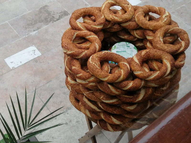
Simit
Simit is a ring-shaped Turkish bread covered in sesame seeds, strongly associated with Istanbul and sold as everyday street food. It is eaten fresh, most often with tea, and has a crisp crust around a chewy crumb.
Explore →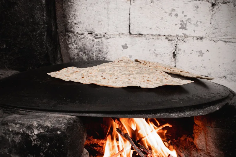
Bazlama
Bazlama is a soft, thick Turkish flatbread made from a leavened dough and cooked on a hot griddle. It is a staple of village baking across Anatolia, eaten warm with butter or used to wrap other foods.
Explore →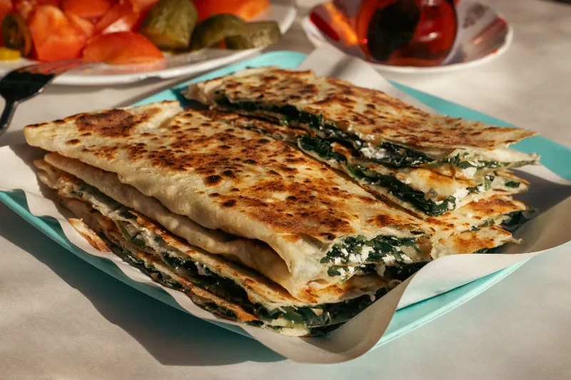
Gözleme
Gözleme is a thin, hand-rolled Anatolian flatbread folded around savory fillings such as cheese, spinach, or minced meat and cooked on a sac griddle. The article covers its regional variations, cooking method, texture, and traditional serving style.
Explore →Related content
Sagalassos
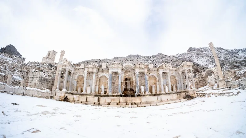
Sagalassos was a major Pisidian city in the Taurus Mountains of Burdur Province, Türkiye. Its Roman theatre, bath complex and monumental fountain house make it one of the more fully understood ancient cities in the region.
Sagalassos
Sagalassos is a ruined Pisidian city in Burdur Province, Türkiye, set high in the Taurus Mountains and best known for its monumental fountain, library and remarkably intact Roman civic buildings.
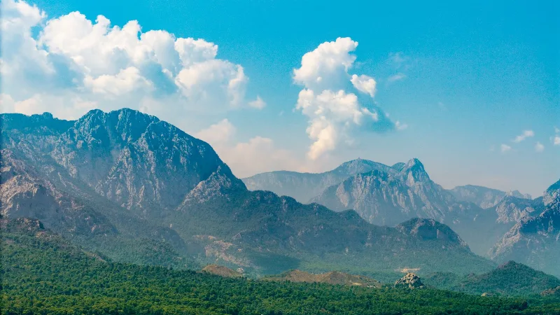
Antalya
Antalya offers a unique blend of vibrant history and stunning natural beauty, making it a must-visit destination in Türkiye.
Sagalassos Ancient City and Mountain Views in Burdur
Sagalassos is a hilltop ancient city in Burdur where Roman streets, theatres and fountains look out across the Taurus Mountains. Its ruins reveal a wealthy Pisidian settlement that traded pottery around the eastern Mediterranean.
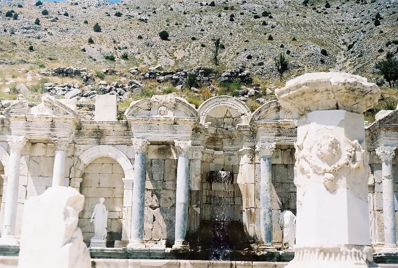
The Ancient City of Sagalassos in the Taurus Mountains
High in the Taurus Mountains above Ağlasun, the ancient city of Sagalassos preserves the streets, fountains and public buildings of a prosperous Pisidian and Roman settlement.
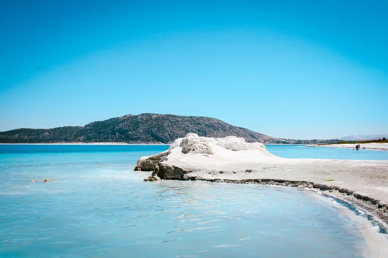
Lake Salda
Lake Salda is a striking lake in Burdur Province, southwestern Türkiye, known for its turquoise water, bright white hydromagnesite beaches and rare microbial stromatolites that draw both nature visitors and planetary scientists.