
Alanya Castle
Alanya Castle is a medieval fortress on a rocky Mediterranean promontory in Antalya Province, Türkiye, whose surviving defences were largely built under the Seljuk Sultanate of Rum in the 13th century. Its walls, inner citadel, Red Tower and vaulted shipyard form one of the most complete Seljuk military and maritime complexes in Anatolia.
Alanya Castle is a medieval fortress occupying a rocky peninsula on the Mediterranean coast of Antalya Province, in southern Türkiye. Its surviving defences belong mainly to the 13th century, when the Seljuk Sultanate of Rum rebuilt the site as a naval stronghold, although the headland had been fortified centuries earlier by Byzantine and Armenian rulers. The castle matters because it preserves an unusually complete Seljuk military and maritime ensemble: a long circuit of walls, a settled lower town, a middle fortress, a summit citadel, and a harbour guarded by the octagonal Red Tower and a vaulted stone shipyard.
The Peninsula and Its Setting
The fortress occupies a promontory that projects southward into the Gulf of Antalya, cut off from the coastal plain behind it by a steep ridge. The highest point of the peninsula, on which the inner citadel stands, rises roughly 250 metres above the sea. The northern, landward side is the gentlest approach and is where the modern town of Alanya has grown up; the southern and western flanks fall away sharply as cliffs to the water. The harbour lies on the eastern side of the promontory, sheltered from the prevailing weather.
Alanya sits roughly 130 kilometres east of Antalya city along the coastal road, close to the point where the coastal strip begins to narrow against the foothills of the Taurus Mountains. The peninsula itself is not large, but its height and its position made it an excellent observation and signalling point over the sea lanes between Anatolia and the eastern Mediterranean.
Before the Seljuks: Coracesium
In antiquity the headland was known as Coracesium, a stronghold on the coast of Rough Cilicia. Its cliffs and natural anchorage made it attractive to pirates, and it was associated with the Cilician corsairs who troubled Mediterranean shipping in the first century BC. In 67 BC the Roman general Pompey brought the pirate war to an end, and Coracesium was drawn into the Roman order. It remained a modest coastal settlement through the Roman and Byzantine periods, defended by fortifications on the hill whose earlier phases now lie buried beneath the medieval walls.
By the early 13th century the area had passed between Byzantine and Armenian control, and the fortified height was held by a local lord. This earlier phase is important for understanding the castle: the Seljuks did not build on empty ground, but refortified and greatly extended a position that had been defended for centuries.
The Seljuk Conquest and Building Campaign
In the early 1220s — conventionally dated to 1221 — the Seljuk sultan Alaeddin Keykubad I took the stronghold and recognised its value as a base for controlling the sea. Rather than leaving it as a small hill fort, he turned it into a planned naval station and residential fortress. The construction that followed in the 1220s is the phase that defines the site today, and it was carried out as a single coordinated programme rather than piecemeal.
The sultan brought craftsmen from outside Anatolia for the most technical structures. The inscriptions and architectural character of the harbour works point to a deliberate, integrated design in which the tower, the shipyard and the sea walls were conceived together.
The Red Tower (Kızıl Kule)
The most recognisable single monument of the complex is the Red Tower, standing at the harbour below the castle. It is octagonal in plan and built of reddish stone, which gives it its Turkish name. It was constructed in the mid-1220s and is attributed to the architect Ebu Ali Reha el Kettani, who came from Aleppo. The tower served as a watchtower and as the corner anchor of the harbour defences, from which the sea approaches and the shipyard could be observed and protected. Its internal levels, spiral stair and embrasures are typical of Seljuk military architecture, and it remains the best-preserved structure of the whole complex.
The Shipyard
Immediately beside the tower is the Seljuk shipyard, built in the later 1220s. It consists of a row of tall vaulted bays opening directly onto the water, where galleys could be drawn up for building and repair. It is regarded as the only Seljuk shipyard to survive substantially intact, and it documents the naval ambitions of the sultanate on this coast. The interior now serves as an exhibition space, and the vaulted structure itself is the main object of interest. Together with the Red Tower, the shipyard is the clearest surviving evidence that Alanya was intended as a working naval base, not merely a refuge.
The Walls and the Three Defensive Zones
The fortifications are organised in three broad zones that climb the peninsula. The outermost circuit, the lower castle, follows the contour of the hill and encloses the largest area; the walls run for several kilometres and are reinforced at intervals by square and polygonal towers. Behind them lies the settled area of the medieval town, where houses, chapels, workshops and cisterns were built inside the protection of the circuit.
Above the lower castle stands the middle fortress known as Ehmedek, which controlled the approach to the summit. At the top is the inner citadel, the smallest and most strongly defended zone. This three-part arrangement — outer town, middle fortress, citadel — reflects a standard medieval defensive logic, with each level able to be held independently if the one below fell.
The Inner Citadel (İç Kale)
The summit citadel is the historical heart of the site. Within its walls are the remains of a Byzantine church, later reused, and the Süleymaniye Mosque, an Ottoman building of the 16th century raised over earlier structures and incorporating spolia from older buildings. A covered market building, the bedesten, and the traces of a palace complex associated with the Seljuk period are also found here.
Water supply was the crucial problem on a dry limestone peninsula, and the answer was storage. Cisterns of various sizes are scattered throughout all three zones, from the citadel down to the lower town, and they are among the most characteristic surviving features of the castle. Their number and distribution show how a substantial population could be sustained on an otherwise waterless rock.
Ehmedek and the Middle Castle
Ehmedek, the middle fortress, takes its name from a later Turkish rendering connected with the garrison and administrative functions once based there. It guarded the road climbing from the lower town to the citadel, and it contained buildings used by the garrison, including a mint in the Ottoman period. Mud brick and rubble walls, gateways and the remains of rooms can still be traced, though the masonry is more weathered than in the citadel above.
The Lower Town and the Harbour
Inside the outer circuit the ground is terraced, and the remains of the medieval settlement are spread across it. Houses, small chapels, storage structures and numerous cisterns survive in fragmentary form. From the citadel, paths descend toward the harbour, where the Red Tower, the shipyard and stretches of the sea wall are grouped closely together. This harbour quarter is where the naval function of the castle is most legible.
One point on the cliff edge is traditionally known as the place from which condemned prisoners were thrown into the sea. This story is repeated locally, but it should be treated as tradition rather than documented history.
Later History: Karamanid and Ottoman Periods
After the decline of Seljuk power the castle passed through the hands of successor principalities and was contested among regional powers. By the later 15th century it had come under Ottoman rule. Under the Ottomans the military importance of the site diminished, but the settlement inside the walls continued, and the citadel acquired the mosque that still stands there. In the following centuries the population gradually shifted down to the plain and the harbour area outside the walls, leaving the upper fortress increasingly to ruin and to a small remaining community.
Alanya Castle is included on Türkiye's UNESCO World Heritage Tentative List; it is not an inscribed World Heritage site.
What Survives Today and What to See
Visitors encounter a large open site rather than a single monument. The essential elements are:
- The Red Tower at the harbour, the best-preserved building of the complex
- The vaulted Seljuk shipyard beside it
- The circuit walls climbing the peninsula, with towers and gateways
- The middle fortress of Ehmedek
- The inner citadel, with the Süleymaniye Mosque, the bedesten and the remains of the Byzantine church
- Cisterns, house foundations and chapels scattered through the lower town
The citadel offers wide views along the coast and over the town, and it is the natural starting point for understanding how the three defensive zones relate to one another. The Alanya Archaeological Museum in the modern town displays material from the region and helps place the castle in a wider chronological context.
Visiting Considerations
The site is spread over a steep, rocky peninsula, and walking between the citadel, Ehmedek and the harbour involves sustained uphill and downhill sections on uneven stone paths. Comfortable shoes and water are advisable, and the exposed rock becomes very hot in high summer. Spring and autumn are generally the most comfortable periods for a full exploration; midsummer visits are better made early in the day.
A cable car connects the lower part of Alanya with the castle area, providing an alternative to the road and footpaths. The harbour monuments and the citadel can also be reached by road. Because the site is extensive, allowing several hours is realistic if the aim is to see both the harbour structures and the summit.
Related Places Nearby
Alanya lies within Antalya Province, and the wider region contains further sites of the same coastal world. The ancient city of Side, with its theatre and temples, lies to the west along the coast, and the archaeological site of Syedra and the remains of Laertes are found in the mountainous hinterland around Alanya. Inland, the Dim Çayı valley and the Taurus foothills provide the geographical context of the castle's defensive position, while the coastal road toward Antalya passes through a series of small historic settlements that shared the same maritime geography.
Routes
All routes →
7-Day North Aegean to Ephesus Route
A seven-day southbound route through Troy, Assos, Bozcaada, Ayvalık, Bergama, İzmir and Ephesus, combining archaeology, coastal towns and Aegean culture.
Explore →
3-Day Thrace Route: Edirne, Kırklareli and Tekirdağ
A practical three-day west-to-east, then south, driving route across Turkish Thrace, linking Edirne's Ottoman monuments with Kırklareli's inland towns and Tekirdağ's Marmara vineyards and coast.
Explore →
1-Day Eskişehir Route
A compact one-day walking route through Eskişehir, moving from the timber houses of Odunpazarı down to the Porsuk River promenade and finishing among the cafés and trams of the modern centre.
Explore →
2-Day Safranbolu and Amasra Route
A two-day route combining Safranbolu’s Ottoman streets and traditional houses with the Black Sea scenery and historic harbour town of Amasra.
Explore →Related content
Alanya
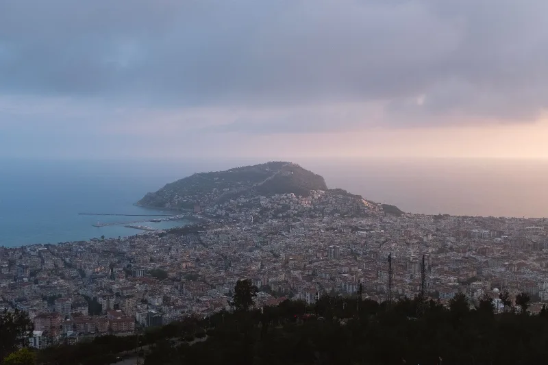
Alanya is a district and coastal city in eastern Antalya Province, Türkiye, built around a Seljuk fortress peninsula that carries the Red Tower, a medieval shipyard and an inhabited old town. Long beaches, a mountain backdrop and a long warm season shape its character.

Antalya
Antalya offers a unique blend of vibrant history and stunning natural beauty, making it a must-visit destination in Türkiye.
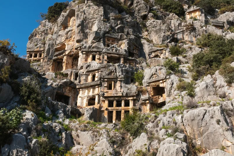
Kale
A working agricultural town on Antalya's Lycian coast, Kale — now usually called Demre — contains the Roman city of Myra, its cliff-cut Lycian rock tombs, a Byzantine church linked to St. Nicholas and the ancient harbour of Andriake.
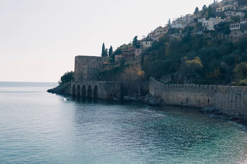
Alanya Castle
Alanya Castle is a 13th-century Seljuk fortress spread across a rocky peninsula above the Mediterranean in Antalya Province, Turkey. Its walls, towers and hilltop citadel form one of the most complete surviving Seljuk defensive complexes in Anatolia.
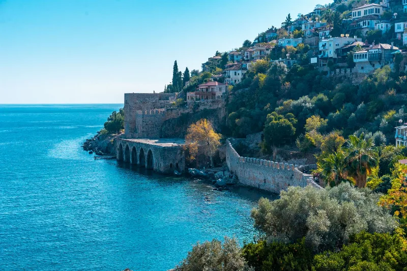
3-Day Alanya and Side Route
A three-day route along Türkiye's eastern Mediterranean coast, starting at Alanya Castle, continuing west to the ancient city of Side, and ending at the Manavgat Waterfalls.
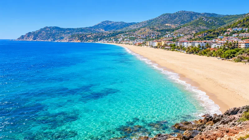
Damlataş
A short, sandy Mediterranean shoreline at the foot of Alanya's limestone headland, taking its name from the cave in the rock above it.