
The Ancient Hittite Capital of Hattusa
STORIES FROM TÜRKİYE
On a windswept plateau in Çorum province, the ruins of Hattusa rise from a landscape of dry grassland, oak scrub and rocky outcrops. The site lies beside the village of Boğazkale, a short drive from the town of Sungurlu, and spreads across a sloping hillside that once held the seat of an empire. For centuries this was the heart of the Hittite state, a power that negotiated and fought with Egypt, Babylon and Assyria. Hattusa has been inscribed on the UNESCO World Heritage List since 1986, and its walls, gates and temples remain among the most substantial remains of the Anatolian Bronze Age.
A Capital on the Anatolian Plateau
The Hittites established their capital here in the 17th century BCE, drawn by defensible high ground, springs and control of routes crossing central Anatolia. Their kings, including Hattusili I, Suppiluliuma I and Tudhaliya IV, extended influence southwards into Syria and eastwards towards Mesopotamia. The city grew in stages, with an older settlement in the lower area and a later expansion enclosed by a long circuit of walls.
The Hittite Empire collapsed around 1180 BCE during the wider upheavals of the Late Bronze Age, and the capital was abandoned. Fire destroyed much of the city, yet it also baked the clay tablets stored in its archives, preserving tens of thousands of cuneiform documents. Those tablets give an unusually detailed picture of diplomacy, law, religion and everyday administration.
Gates, Temples and the Upper City
The fortifications are the most visible feature of Hattusa. Massive stone foundations, casemate walls and earthen ramps follow the contours of the hill, and three decorated gateways mark the southern and western approaches. The Lion Gate carries a relief of a lion in high relief, while the King's Gate shows a warrior figure carved into the stone block above the opening.
At Yerkapı, the Sphinx Gate sits on top of an artificial mound, with a sloping ramp and a stone-lined tunnel passing beneath the walls. In the Lower City, the Great Temple, known as Temple 1, was dedicated to the storm god and the sun goddess of Arinna. Storerooms around its courtyard once held grain, oil, wine and metal goods, suggesting the temple also functioned as an economic centre.
The Royal Citadel and the Written Record
Büyükkale, the royal citadel, occupies a rocky outcrop above the city. Excavations there revealed audience halls, courtyards, archive rooms and residential quarters, arranged across terraces. The layout points to a structured court life, with spaces for receiving officials, storing records and housing the royal household.
The Hittite language recorded on the tablets is the oldest documented Indo-European language. The archive includes laws, treaties, letters, ritual instructions and inventory lists. Among the most celebrated documents is the peace agreement concluded between Hattusili III and the Egyptian pharaoh Ramesses II after the Battle of Kadesh, a text that shows how far Hittite diplomacy reached.
Yazılıkaya: Gods Carved in Stone
A short distance from the city, the open-air sanctuary of Yazılıkaya uses natural limestone outcrops as a setting for carved reliefs. In the larger chamber, two processions of deities face each other, with figures representing gods, goddesses and mountains. The smaller chamber includes a relief associated with Tudhaliya IV and a striking depiction of a sword-shaped deity.
The sanctuary was not a temple building but a ceremonial space integrated into the rock. Its carvings offer a rare view of Hittite religious imagery, since most other representations survive only as fragments or small objects. Together with the city itself, Yazılıkaya helps explain how the Hittites pictured their pantheon and their rulers.
Around Hattusa: Alacahöyük and Local Flavours
Roughly thirty kilometres away, the mound of Alacahöyük contains layers from the Chalcolithic period through to the Hittite era, including a gate decorated with sphinxes and royal tombs with rich grave goods. The surrounding countryside of Çorum is open steppe and farmland, crossed by the Budaközü stream and dotted with small villages.
Food in the region follows the rhythms of that landscape. Çorum is widely known for leblebi, roasted chickpeas prepared in several ways, and for İskilip dolması, a layered rice dish cooked with meat and fruit. Keşkek, a hearty dish of cracked wheat and meat pounded together, appears at weddings and festivals, while mantı and home-baked breads are common on family tables.
In Hittite times, the diet relied on barley, wheat, lentils, honey, fruit and wine, stored in large ceramic jars of the kind found in the city's storerooms. Spring and autumn are comfortable seasons for walking among the ruins, while summers are hot and dry and winters bring snow to the plateau. Visiting the site and the nearby sanctuary in the same day gives a rounded sense of how this ancient capital worked as a political, religious and agricultural centre.
Historic places
Explore history →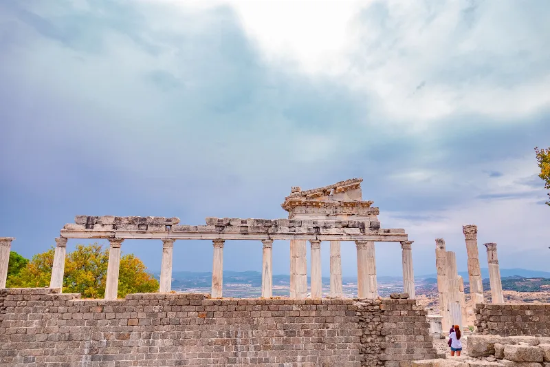
Pergamon
Pergamon was the Hellenistic capital of the Attalid dynasty in western Türkiye, built around a steep acropolis above the modern town of Bergama. Its Great Altar, theatre and Sanctuary of Asclepius make it one of the most important archaeological sites in Anatolia and a UNESCO World Heritage Site.
Explore →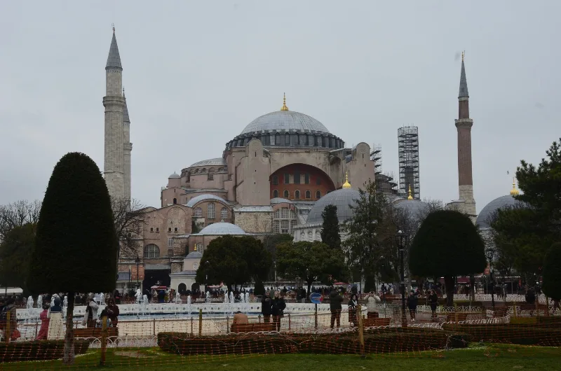
Hagia Sophia
Hagia Sophia in Istanbul is a monumental religious building begun under the Byzantine emperor Justinian I in 537 CE, later converted into an Ottoman mosque and today serving again as a mosque and UNESCO-listed monument.
Explore →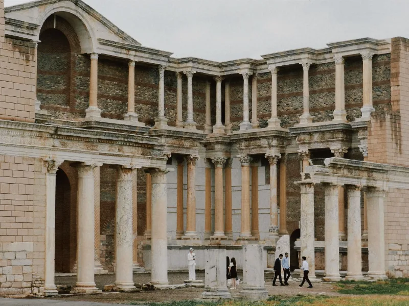
Sardis
Sardis was the Iron Age capital of the Lydian Kingdom in western Anatolia and later a major Roman and Byzantine city. Its surviving monuments include the Temple of Artemis, a vast bath-gymnasium complex and one of the largest ancient synagogues ever found.
Explore →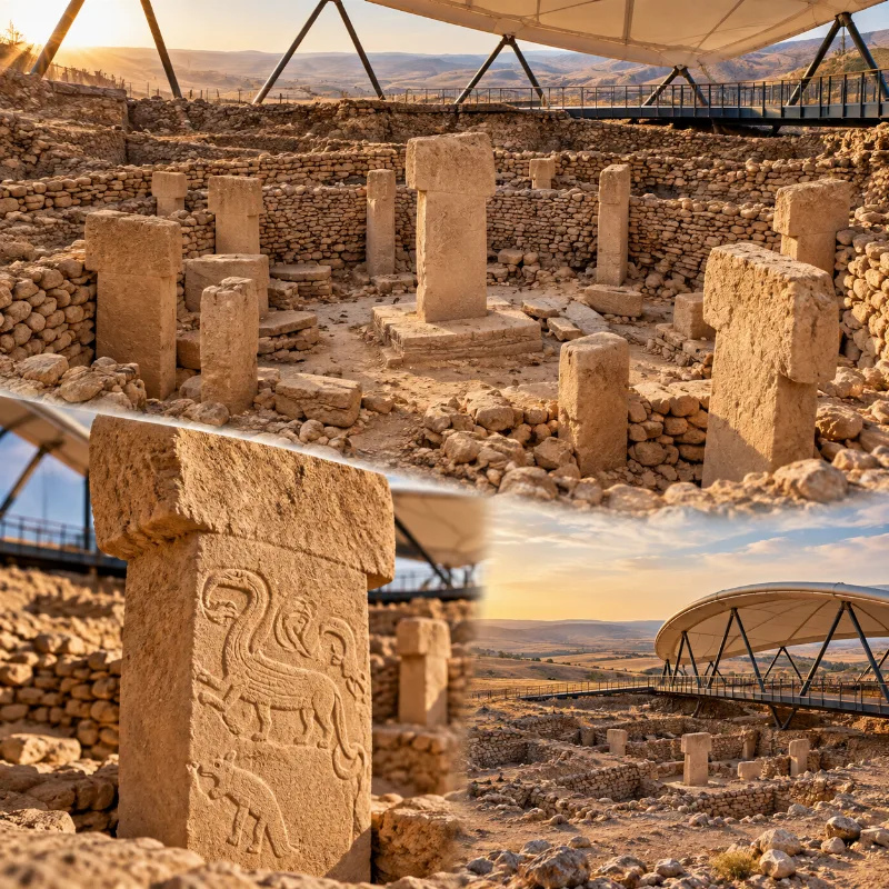
Göbeklitepe
A major Neolithic archaeological site near Şanlıurfa, known for its monumental stone enclosures and carved T-shaped pillars.
Explore →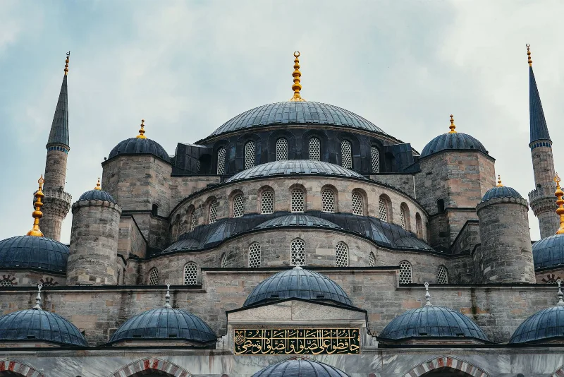
Blue Mosque
The Blue Mosque, known formally as the Sultan Ahmed Mosque, is an early 17th-century Ottoman mosque in Istanbul famous for its hand-painted blue Iznik tiles and six minarets.
Explore →Related content
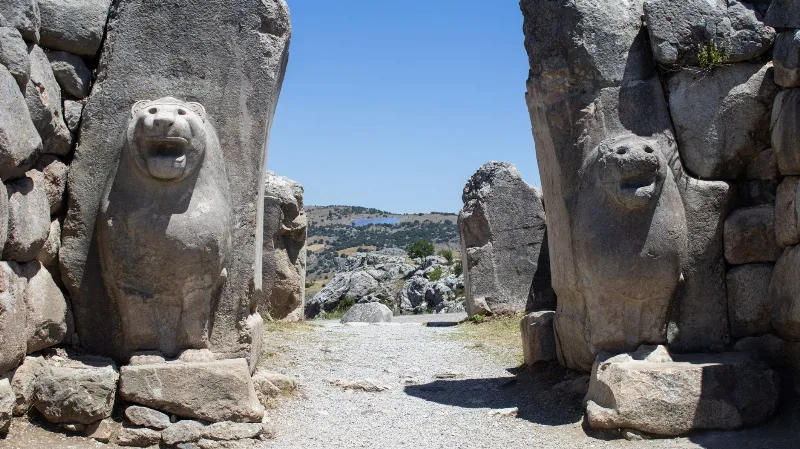
Hattusa
Hattusa was the capital of the Hittite Empire, located near Boğazkale in Çorum Province. Its surviving walls, gates, temples and cuneiform archives make it one of the most important Bronze Age archaeological sites in Anatolia.
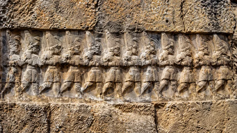
Yazılıkaya
Yazılıkaya is an open-air Hittite rock sanctuary cut into limestone near the ancient capital of Hattusa, decorated with reliefs of gods and kings and now part of a UNESCO World Heritage Site.
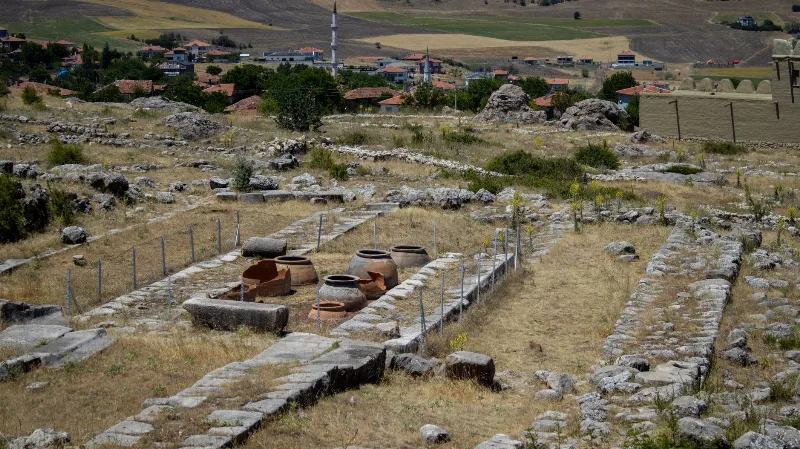
Alacahöyük
In Çorum Province, Alacahöyük preserves a long settlement sequence, elite Early Bronze Age burials and a monumental Hittite gate with carved reliefs.
Hattusa: The Hittite Capital at Boğazkale, Çorum
Hattusa was the seat of the Hittite Empire in the Late Bronze Age and is now a UNESCO World Heritage Site in Çorum Province, Türkiye. Its walls, temples, gates and the nearby rock sanctuary of Yazılıkaya make it one of the most important archaeological landscapes in the ancient Near East.
Alacahöyük: A Hittite City and Early Bronze Age Royal Tombs in Çorum
Alacahöyük is an excavated mound in Çorum Province that holds both Early Bronze Age royal tombs and a monumental Hittite gate flanked by carved sphinxes. It is one of the key sites for reading the pre-Hittite and Hittite past of central Anatolia.
Historic Places
Ancient cities, monuments, castles and archaeological sites across Türkiye.